Home > Arts > Artists > M > Gerardus Mercator
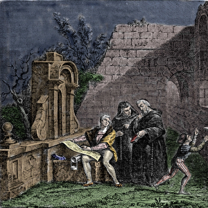
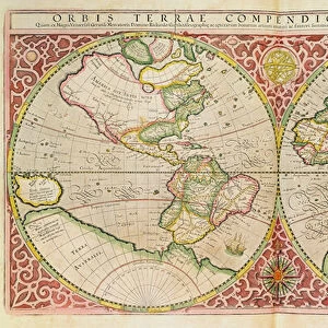
Groningen and Friesland, Netherlands (engraving, 1596)
")
![]()
Wall Art and Photo Gifts from Fine Art Finder
Groningen and Friesland, Netherlands (engraving, 1596)
LRI4717756 Groningen and Friesland, Netherlands (engraving, 1596) by Mercator, Gerardus (1512-94); Private Collection; (add.info.: Frisia occidentalis, 1632: Groningen (Groningen) and Friesland (Friesland), Netherlands - in " Atlas Ssive Corsmographicae Meditationes" by Gerard Mercator (Gerard de Kremer - Gerhard Kremer - Gerardus Mercator) (1512-1594), Duisburg 1596); Luisa Ricciarini; Flemish, out of copyright
Media ID 23328418
© Luisa Ricciarini / Bridgeman Images
Atlas Book Geographical Map Neerlanders
FEATURES IN THESE COLLECTIONS
> Animals
> Mammals
> Phyllostomidae
> Occidentalis
> Animals
> Mammals
> Pteropodidae
> Occidentalis
> Arts
> Artists
> M
> Gerardus Mercator
> Europe
> Netherlands
> Groningen
> Europe
> Netherlands
> Maps
> Fine Art Finder
> Artists
> Anonymous
> Fine Art Finder
> Artists
> Gerardus Mercator
> Maps and Charts
> Gerardus Mercator's Cartographic
> Maps and Charts
> Netherlands
EDITORS COMMENTS
This print showcases an exquisite engraving from 1596, depicting the enchanting regions of Groningen and Friesland in the Netherlands. Created by the renowned cartographer Gerardus Mercator, this masterpiece offers a glimpse into the rich history and geographical beauty of these Dutch provinces. The intricate details captured in this engraving transport us back to a time when exploration and discovery were at their peak. The delicate lines etched by Mercator reveal the contours of land and water, showcasing his exceptional skill in mapmaking. From the winding rivers to the sprawling fields, every element is meticulously depicted, inviting viewers to immerse themselves in this historical landscape. As we gaze upon this artwork, we are reminded of Mercator's significant contribution to cartography during his lifetime. His work not only served as a navigational tool but also ignited curiosity about distant lands and cultures. Preserved within a private collection, this particular print evokes a sense of nostalgia for an era long gone. It serves as a testament to both Mercator's talent and Luisa Ricciarini's dedication to preserving fine art for future generations. Through its timeless appeal, "Groningen and Friesland" invites us on an imaginary journey through centuries past—a visual reminder that even amidst modern advancements, there is still much value in appreciating our historical roots.
MADE IN AUSTRALIA
Safe Shipping with 30 Day Money Back Guarantee
FREE PERSONALISATION*
We are proud to offer a range of customisation features including Personalised Captions, Color Filters and Picture Zoom Tools
SECURE PAYMENTS
We happily accept a wide range of payment options so you can pay for the things you need in the way that is most convenient for you
* Options may vary by product and licensing agreement. Zoomed Pictures can be adjusted in the Cart.