Home > Europe > France > Paris > Maps
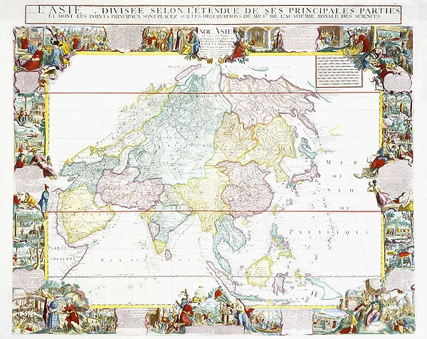
Map of Asia, 1786 (hand-coloured engraving)
![]()

Wall Art and Photo Gifts from Fine Art Finder
Map of Asia, 1786 (hand-coloured engraving)
986319 Map of Asia, 1786 (hand-coloured engraving) by Desnos, Louis-Charles (c.1725-c.1800); 100x119 cm; Private Collection; (add.info.: Map of Asia; L Asie.... Louis-Charles Desnos (c.1725-c.1800). Hand-coloured engraving. Printed in Paris, 1786 (a reissue of Nolins 1760 copy of the Danets map of 1724, with borders deriving from de Fers map of Asia, circa 1700). 100 x 119cm.); Photo eChristies Images; French, out of copyright
Media ID 23293084
© Christie's Images / Bridgeman Images
1780s 1786 Background People Bordered Bystander Capital Letter Cartography Continent Engraved Frame French Text Geographic Hand Colored Hand Coloring Hand Coloured Hand Colouring Hand Tinted Handcolored Language Late 18th Century Late Eighteenth Century Lettering Navigational Equipment Olden Time Prints Word Handcoloured
FEATURES IN THESE COLLECTIONS
> Arts
> Artists
> Related Images
> Asia
> Related Images
> Europe
> France
> Paris
> Maps
> Fine Art Finder
> Artists
> Louis-Charles Desnos
> Fine Art Finder
> Artists
> Théodose du Moncel
> Fine Art Finder
> Temp Classification
EDITORS COMMENTS
This print showcases a stunning "Map of Asia, 1786" by Louis-Charles Desnos. Hand-coloured and engraved with intricate detail, this piece is a true testament to the artistry of cartography in the late eighteenth century. Measuring at an impressive 100x119 cm, this map offers a comprehensive view of Asia during that era. It is worth noting that it is actually a reissue of Nolins' 1760 copy of the Danets map from 1724, featuring borders inspired by de Fers' map from around 1700. The combination of these historical elements adds depth and richness to the overall composition. The hand-colouring technique employed on this engraving brings life to every corner of the map. Each region is beautifully highlighted with vibrant hues, making it visually striking and engaging for any viewer. As we delve into its details, we can appreciate not only its navigational purpose but also its artistic value. The French text accompanying the map provides additional context and insight into how people perceived geography during that time period. This print captures not just a mere representation of Asia's geographical features but also serves as an exquisite work of art. Its bordered frame further enhances its aesthetic appeal while preserving its historical significance. Whether you are fascinated by maps or intrigued by history, this remarkable piece will undoubtedly captivate your imagination and transport you back to the late eighteenth century when exploration was at its peak.
MADE IN AUSTRALIA
Safe Shipping with 30 Day Money Back Guarantee
FREE PERSONALISATION*
We are proud to offer a range of customisation features including Personalised Captions, Color Filters and Picture Zoom Tools
SECURE PAYMENTS
We happily accept a wide range of payment options so you can pay for the things you need in the way that is most convenient for you
* Options may vary by product and licensing agreement. Zoomed Pictures can be adjusted in the Cart.


