Home > Europe > Austria > Maps
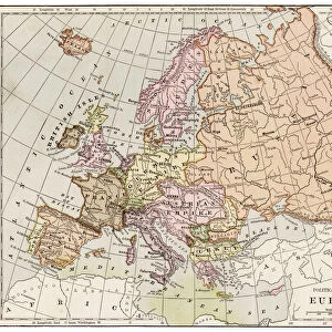
Western and Central Europe map 1881

![]()
Wall Art and Photo Gifts from Fine Art Storehouse
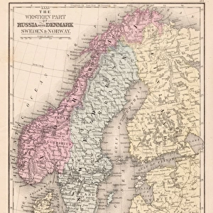
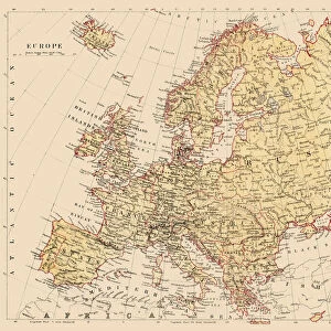
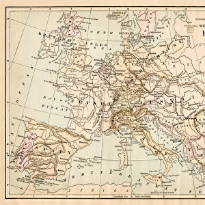
Western and Central Europe map 1881
Harpers School Geography, New York, Harpers and Brothers, 1881
Unleash your creativity and transform your space into a visual masterpiece!
THEPALMER
Media ID 14756074
© This content is subject to copyright
Austria Denmark Norway Portugal Russia Sweden
FEATURES IN THESE COLLECTIONS
> Fine Art Storehouse
> Map
> Denmark Maps
> Fine Art Storehouse
> Map
> Historical Maps
> Fine Art Storehouse
> Map
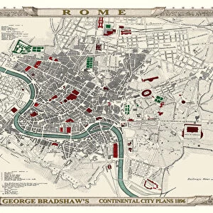
> Italian Maps
EDITORS COMMENTS
This print showcases a historical gem, the "Western and Central Europe map 1881" sourced from Harpers School Geography in New York. Published by Harpers and Brothers back in 1881, this remarkable piece of cartographic art takes us on a journey through time to explore the intricate details of European geography during that era. The map encompasses an array of countries that shaped Western and Central Europe's landscape at the time. From Portugal to Russia, it vividly depicts nations such as Austria, Denmark, France, Germany, Italy, Norway, Spain, Sweden - each with its distinctive borders and geographical features. This meticulously crafted artwork offers a glimpse into the political boundaries prevalent over a century ago. "ThePALMER" has expertly captured this vintage masterpiece for all history enthusiasts to admire. The attention to detail is truly commendable; every contour line and topographical element is beautifully preserved within this print. It serves as both an educational tool for geography aficionados and a stunning decorative piece for any space. Whether displayed in classrooms or adorning personal spaces like offices or living rooms, this Fine Art Storehouse print invites viewers to immerse themselves in the rich tapestry of European history. With its timeless charm and evocative allure, it transports us back to an era when maps were not just navigational aids but also works of art that encapsulated our understanding of the world around us.
MADE IN AUSTRALIA
Safe Shipping with 30 Day Money Back Guarantee
FREE PERSONALISATION*
We are proud to offer a range of customisation features including Personalised Captions, Color Filters and Picture Zoom Tools
SECURE PAYMENTS
We happily accept a wide range of payment options so you can pay for the things you need in the way that is most convenient for you
* Options may vary by product and licensing agreement. Zoomed Pictures can be adjusted in the Cart.