Framed Print > Sheffield City Archives > Maps and Plans > Bowen's County Maps, c. 1777
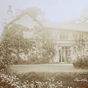
Framed Print : County Map of Westmoreland and Cumberland, c. 1777


![]()
Framed Photos from Sheffield City Archives
County Map of Westmoreland and Cumberland, c. 1777
From The Large English Atlas: or, a new set of map of all the counties of England and Wales drawn from the several surveys which have been hitherto been published. With three general maps of England, Scotland and Ireland, from the latest and best authorities, by Emanuel Bowen, Thomas Kitchin and others. London, printed and sold by T. Bowles, [c.1777]
Original at Sheffield Libraries: 912 STF
Sheffield City Archives and Local Studies Library has an unrivalled collection of images of Sheffield, England
Media ID 25501515
© Sheffield City Council - All Rights Reserved
Antique Map Bowens Map County Map Emanuel Bowen Holme Old Map Thomas Kitchin Allerdale Ambleside Appleby Bampton Barton Brampton Brough Cockermouth Cumberland Egremont Eskdale Grasmere Kendal Kentmere Keswick Kirkby Lonsdale Kirkby Stephen Lake District Maryport Millom Orton Patterdale Penrith Shap Tebay Westmoreland Westmorland Whitehaven Wigton Windermere Workington
21.5"x17.5" (55x44cm) Premium Frame
Adorn your home or office with a piece of historical charm. Introducing the Media Storehouse Framed Print of the County Map of Westmoreland and Cumberland, c. 1777. This exquisite print is taken from The Large English Atlas, showcasing the intricate details of the counties as they appeared over 250 years ago. The map, sourced from Sheffield City Archives, is a fascinating glimpse into the past, perfect for history enthusiasts, collectors, or anyone looking to add a unique touch to their decor. With its antique charm and high-quality framing, this print is sure to become a conversation starter and a cherished addition to your space.
Framed and mounted 17x12 print. Professionally handmade full timber moulded frames are finished off with framers tape and come with a hanging solution on the back. Outer dimensions are 21.5x17.5 inches (546x444mm). Quality timber frame frame moulding (20mm wide and 30mm deep) with frame colours in your choice of black, white, or raw oak and a choice of black or white card mounts. Frames have a perspex front providing a virtually unbreakable glass-like finish which is easily cleaned with a damp cloth.
Contemporary Framed and Mounted Prints - Professionally Made and Ready to Hang
Estimated Image Size (if not cropped) is 41.8cm x 41.8cm (16.5" x 16.5")
Estimated Product Size is 44.4cm x 54.6cm (17.5" x 21.5")
These are individually made so all sizes are approximate
Artwork printed orientated as per the preview above, with landscape (horizontal) or portrait (vertical) orientation to match the source image.
EDITORS COMMENTS
This print showcases a County Map of Westmoreland and Cumberland, dating back to approximately 1777. The map is an exquisite piece from "The Large English Atlas: or, a new set of maps of all the counties of England and Wales" meticulously crafted by renowned cartographers Emanuel Bowen, Thomas Kitchin, and others. With its intricate details and historical significance, this antique map offers a glimpse into the past. It highlights various towns and landmarks within Westmoreland and Cumberland such as Appleby, Brough, Kirkby Stephen, Orton, Tebay, Askham, Bampton, Barton, Patterdale, Shap, Yanwith Ambleside, Burton in Kendal, and many more. The map also encompasses notable regions like the Lake District with its picturesque landscapes including Grasmere, Kentmere, Windermere, Kirkby Lonsdale, Cumberland's Allerdale, Eskdale, and Leath. Additionally, it features significant towns like Carlisle, Wigton, Brampton, Cleator Moor, Cockermouth, Egremont, Holme Cultram, Keswick, Maryport , Millom, Penrith , Whitehaven , and Workington. Preserved at Sheffield Libraries (912 STF), this remarkable artifact provides valuable insights into the geography and history of these counties during that era. Its inclusion in the archives signifies its importance as a cultural heritage item. As we explore this enchanting image capturing centuries-old cartographic expertise by Bowen
MADE IN AUSTRALIA
Safe Shipping with 30 Day Money Back Guarantee
FREE PERSONALISATION*
We are proud to offer a range of customisation features including Personalised Captions, Color Filters and Picture Zoom Tools
SECURE PAYMENTS
We happily accept a wide range of payment options so you can pay for the things you need in the way that is most convenient for you
* Options may vary by product and licensing agreement. Zoomed Pictures can be adjusted in the Cart.