Fraud Blocker Skip to main content

Globe Navigational Equipment Collection (page 5)

"Exploring the World

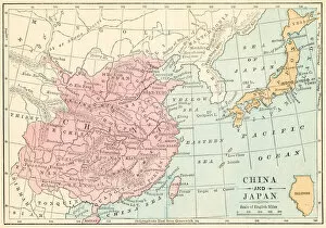
Background imageGlobe Navigational Equipment Collection: China and Japan map 1875

China and Japan map 1875
The Independent Course Comprehensive Geography by James Monteith, A.S. Barnes & Co, New York & Chicago 1875

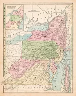
Background imageGlobe Navigational Equipment Collection: USA middle states map 1875

USA middle states map 1875
The Independent Course Comprehensive Geography by James Monteith, A.S. Barnes & Co, New York & Chicago 1875

Background imageGlobe Navigational Equipment Collection: Spain and Portugal map 1875

Spain and Portugal map 1875
The Independent Course Comprehensive Geography by James Monteith, A.S. Barnes & Co, New York & Chicago 1875

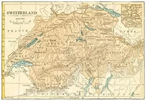
Background imageGlobe Navigational Equipment Collection: Switzerland map 1875

Switzerland map 1875
The Independent Course Comprehensive Geography by James Monteith, A.S. Barnes & Co, New York & Chicago 1875

Background imageGlobe Navigational Equipment Collection: South America relief map 1875

South America relief map 1875
The Independent Course Comprehensive Geography by James Monteith, A.S. Barnes & Co, New York & Chicago 1875

Background imageGlobe Navigational Equipment Collection: New York and Jersey map 1875

New York and Jersey map 1875
The Independent Course Comprehensive Geography by James Monteith, A.S. Barnes & Co, New York & Chicago 1875

Background imageGlobe Navigational Equipment Collection: Astronomical geography map 1875

Astronomical geography map 1875
The Independent Course Comprehensive Geography by James Monteith, A.S. Barnes & Co, New York & Chicago 1875

Background imageGlobe Navigational Equipment Collection: Holland and Belgium map 1875 and Belgium map 1875

Holland and Belgium map 1875 and Belgium map 1875
The Independent Course Comprehensive Geography by James Monteith, A.S. Barnes & Co, New York & Chicago 1875

Background imageGlobe Navigational Equipment Collection: North America relief map 1875

North America relief map 1875
The Independent Course Comprehensive Geography by James Monteith, A.S. Barnes & Co, New York & Chicago 1875

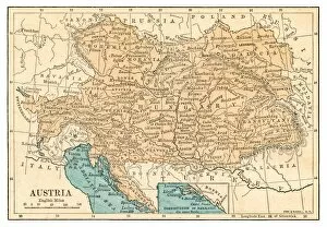
Background imageGlobe Navigational Equipment Collection: Austria map 1875

Austria map 1875
The Independent Course Comprehensive Geography by James Monteith, A.S. Barnes & Co, New York & Chicago 1875

Background imageGlobe Navigational Equipment Collection: USA states map 1875

USA states map 1875
The Independent Course Comprehensive Geography by James Monteith, A.S. Barnes & Co, New York & Chicago 1875

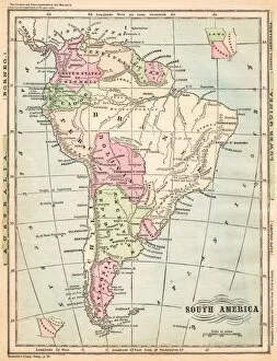
Background imageGlobe Navigational Equipment Collection: South America map 1875

South America map 1875
The Independent Course Comprehensive Geography by James Monteith, A.S. Barnes & Co, New York & Chicago 1875

Background imageGlobe Navigational Equipment Collection: The world in hemispheres map 1875

The world in hemispheres map 1875
The Independent Course Comprehensive Geography by James Monteith, A.S. Barnes & Co, New York & Chicago 1875

Background imageGlobe Navigational Equipment Collection: States USA map 1875

States USA map 1875
The Independent Course Comprehensive Geography by James Monteith, A.S. Barnes & Co, New York & Chicago 1875

Background imageGlobe Navigational Equipment Collection: Routes of travel in the United States map 1875

Routes of travel in the United States map 1875
The Independent Course Comprehensive Geography by James Monteith, A.S. Barnes & Co, New York & Chicago 1875

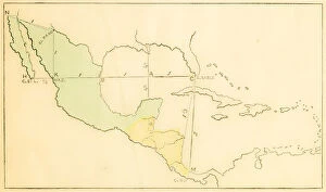
Background imageGlobe Navigational Equipment Collection: Central America and West Indies map 1875

Central America and West Indies map 1875
The Independent Course Comprehensive Geography by James Monteith, A.S. Barnes & Co, New York & Chicago 1875

Background imageGlobe Navigational Equipment Collection: The history of geography map 1895

The history of geography map 1895
Meyers Konversations-Lexikon. Ein Nachschlagewerk des allgemeinen Wissens, 5th edition 17 volumes Bibliographisches Institut - Leipzig 1895-1897

Background imageGlobe Navigational Equipment Collection: World map 1895

World map 1895
Meyers Konversations-Lexikon. Ein Nachschlagewerk des allgemeinen Wissens, 5th edition 17 volumes Bibliographisches Institut - Leipzig 1895-1897

Background imageGlobe Navigational Equipment Collection: World spread of hardwood map 1895

World spread of hardwood map 1895
Meyers Konversations-Lexikon. Ein Nachschlagewerk des allgemeinen Wissens, 5th edition 17 volumes Bibliographisches Institut - Leipzig 1895-1897

Background imageGlobe Navigational Equipment Collection: Antique colored illustrations: Isothermal lines and ethnicities of the World

Antique colored illustrations: Isothermal lines and ethnicities of the World

Background imageGlobe Navigational Equipment Collection: Antique engraving illustration: World map

Antique engraving illustration: World map

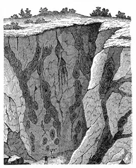
Background imageGlobe Navigational Equipment Collection: Veins in limestone on Monte Calvi

Veins in limestone on Monte Calvi
Illustration of a Veins in limestone on

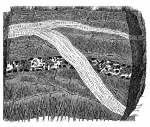
Background imageGlobe Navigational Equipment Collection: Section of a terrain, double vein

Section of a terrain, double vein

Background imageGlobe Navigational Equipment Collection: Part of a Freiberg ore mine: sulphur, quartz, gneiss

Part of a Freiberg ore mine: sulphur, quartz, gneiss
Illustration of a Freiberg ore mine: sulphur, quartz, gneiss

Background imageGlobe Navigational Equipment Collection: Section of a terrain

Section of a terrain, ramification and enforcement

Background imageGlobe Navigational Equipment Collection: World Exhibition in Paris

World Exhibition in Paris

Background imageGlobe Navigational Equipment Collection: Map of plant geography

Map of plant geography

Background imageGlobe Navigational Equipment Collection: Maps for history of geography

Maps for history of geography

Background imageGlobe Navigational Equipment Collection: Rangoon

Rangoon
Antique illustration of Rangoon

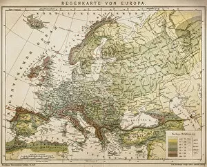
Background imageGlobe Navigational Equipment Collection: Rain map of Europe

Rain map of Europe
Antique illustration of a rain map of Europe

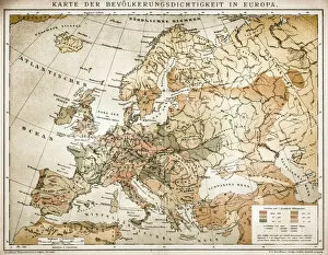
Background imageGlobe Navigational Equipment Collection: Population tightness map of Europe

Population tightness map of Europe

Background imageGlobe Navigational Equipment Collection: Ethnographic map of Europe

Ethnographic map of Europe from 1898

Background imageGlobe Navigational Equipment Collection: Political outline map of Europe

Political outline map of Europe from 1898

Background imageGlobe Navigational Equipment Collection: Westminster Abbey

Westminster Abbey or Collegiate Church of St Peter in London, England, during the 1890s

Background imageGlobe Navigational Equipment Collection: Engraving vintage Planetarium

Engraving vintage Planetarium

Background imageGlobe Navigational Equipment Collection: Overview map world traffic

Overview map world traffic

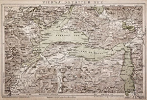
Background imageGlobe Navigational Equipment Collection: Lake Lucerne

Lake Lucerne
Antique map of LAKE LUCERNE

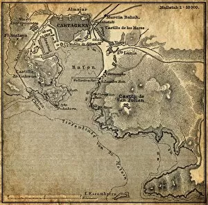
Background imageGlobe Navigational Equipment Collection: Cartagena, Spain

Cartagena, Spain
Antique illustration of a Cartagena, Spain map

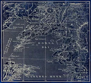
Background imageGlobe Navigational Equipment Collection: Map of Korea, China

Map of Korea, China
Antique illustration of a Map of Korea, China

Background imageGlobe Navigational Equipment Collection: Lunar Map

Lunar Map
Antique illustration of a Lunar Map

Background imageGlobe Navigational Equipment Collection: Eastern Canada and Newfoundland

Eastern Canada and Newfoundland
Illustration of a Eastern Canada and Newfoundland

Background imageGlobe Navigational Equipment Collection: Earth map according to Claudius Ptolemaeus

Earth map according to Claudius Ptolemaeus
Antique illustration of a earth map according to Claudius Ptolemaeus

Background imageGlobe Navigational Equipment Collection: Nidaros Cathedral in Trondheim, Norway

Nidaros Cathedral in Trondheim, Norway
Illustration of a Nidaros Cathedral in Trondheim, Norway

Background imageGlobe Navigational Equipment Collection: United States of America, eastern part

United States of America, eastern part
Antique illustration of a United States of America, eastern part

Background imageGlobe Navigational Equipment Collection: United States of America, Middle section

United States of America, Middle section
Antique illustration of a United States of America, Middle section

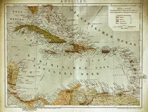
Background imageGlobe Navigational Equipment Collection: West indies, Antilles map

West indies, Antilles map
Illustration of a West indies, Antilles map

Background imageGlobe Navigational Equipment Collection: Local time world map

Local time world map
Antique illustration of a local time world map

Background imageGlobe Navigational Equipment Collection: The World map

The World map
Antique illustration of a map of the World


All Professionally Made to Order for Quick Shipping

"Exploring the World: Navigating with Globe Navigational Equipment" Embark on a journey through time and space as we delve into the fascinating world of globe navigational equipment. From ancient maps to celestial models, these tools have guided explorers, scholars, and dreamers alike. Step back in time with the Map of Ireland from 1897, an intricate depiction of this enchanting land's topography and history. Travel further east to Palestine map from 1875, unraveling its rich cultural tapestry etched onto paper. Explore England and Wales through a map dating back to 1875, tracing the footsteps of generations past. Venture southward towards Spain and France with a map from 1869 - witness how borders have shifted over time while marveling at their shared heritage. As twilight descends upon Kathmandu's Boudhanath Stupa in Nepal, let your gaze wander upwards to celestial wonders depicted by Ptolemy, Copernicus, and Tycho in their geocentric and heliocentric models. Pause for reflection as you encounter Charon the ferryman engraving - a reminder of life's transient nature amidst our quest for knowledge. Continue your exploration across Italy via a map from 1875 or venture northwards towards Scotland where tales of clans unfold on another captivating cartographic piece. Discover Strabo's vision of the world through his ancient map that shaped perceptions centuries ago. Immerse yourself in spiritual traditions as prayer flags flutter alongside Nepal's iconic Boudhanath Stupa. Finally, travel back even further in time with Martin Behaim's wood engraving depicting his world map from 1492 - an invaluable artifact that captures mankind's evolving understanding of our planet. These glimpses into history remind us that globe navigational equipment has been instrumental in shaping our collective understanding of geography, culture, science, and spirituality throughout millennia.