Home > Historic > Ancient civilizations > Ancient Greece > Greek history
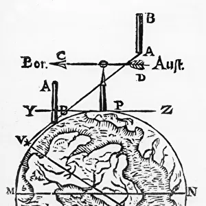
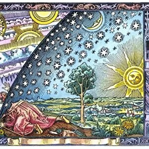
Map of the World, According to Ptolemy, 1923. Creator: Agathodaemon of Alexandria

![]()
Wall Art and Photo Gifts from Heritage Images
Map of the World, According to Ptolemy, 1923. Creator: Agathodaemon of Alexandria
Map of the World, According to Ptolemy, 1923. From " Australia, New Zealand and Oceania in Pictures", by H. Clive Barnard, M.A. Blitt. [A. & C. Black, Limited, London, 1923]
Heritage Images features heritage image collections
Media ID 18322492
© The Print Collector/Heritage Images
2nd Century Alexandria Barnard Cartography Claudius Claudius Of Ptolemaeus Claudius Ptolemy H Clive H Clive Barnard Map Making Ptolemaic Ptolemy World Map
FEATURES IN THESE COLLECTIONS
> Arts
> Literature
> Arts
> Minimalist artwork
> Monochrome artwork
> Fine art
> Arts
> Minimalist artwork
> Monochrome artwork
> Monochrome paintings
> Europe
> Greece
> Related Images
> Historic
> Ancient civilizations
> Ancient Greece
> Greek history
> Maps and Charts
> Related Images
EDITORS COMMENTS
This print showcases a fascinating piece of history - the "Map of the World, According to Ptolemy" created by Agathodaemon of Alexandria in 1923. This map, featured in the book "Australia, New Zealand and Oceania in Pictures" by H. Clive Barnard, offers a glimpse into how ancient cartography influenced early 20th-century interpretations. Agathodaemon's work is based on the original map created by Claudius Ptolemy, a Greek geographer from the 2nd century. The intricate details and precision displayed on this monochrome image highlight Agathodaemon's dedication to accuracy while paying homage to Ptolemy's groundbreaking contributions. The map depicts various continents and countries known during that time period, providing insight into geographical knowledge at that specific moment in history. It serves as a reminder of how our understanding of the world has evolved over centuries. Through this studio shot captured by The Print Collector, viewers are transported back to an era when maps were not just navigational tools but also works of art and literature. The craftsmanship exhibited here reflects both Agathodaemon's skill as well as his appreciation for historical cartography. As we observe this print today, it sparks curiosity about our ever-changing perception of geography and reminds us that even though time progresses rapidly, remnants from different eras continue to shape our understanding of the world around us.
MADE IN AUSTRALIA
Safe Shipping with 30 Day Money Back Guarantee
FREE PERSONALISATION*
We are proud to offer a range of customisation features including Personalised Captions, Color Filters and Picture Zoom Tools
SECURE PAYMENTS
We happily accept a wide range of payment options so you can pay for the things you need in the way that is most convenient for you
* Options may vary by product and licensing agreement. Zoomed Pictures can be adjusted in the Cart.