Jigsaw Puzzle > Europe > United Kingdom > England > Oxfordshire > Dorchester
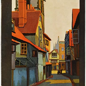
Jigsaw Puzzle : 1832 Victorian Map of Wallingford


![]()
Jigsaw Puzzles from Mary Evans Picture Library
1832 Victorian Map of Wallingford
Mary Evans Picture Library makes available wonderful images created for people to enjoy over the centuries
Media ID 32351966
© The Keasbury-Gordon Photograph Archive / Mary Evans
1832 Borough Boroughs Boundaries Boundary Constituencies Constituency Dorchester Oxfordshire Parliament Parliamentary Reform Wallingford
Jigsaw Puzzle (500 Pieces)
Discover the rich history of Wallingford with our captivating 1832 Victorian Map of Wallingford jigsaw puzzle from The Keasbury-Gordon Photograph Archive Collection, available at Media Storehouse. This intricately detailed puzzle features an antique map that transports you back in time, allowing you to explore the streets and landmarks of Wallingford as they appeared over 150 years ago. Immerse yourself in the charm of this historic English town and enjoy the satisfying experience of piecing together this beautiful puzzle. A perfect activity for puzzle enthusiasts, history buffs, or anyone seeking a engaging and educational pastime.
500 piece puzzles are custom made in Australia and hand-finished on 100% recycled 1.6mm thick laminated puzzle boards. There is a level of repetition in jigsaw shapes with each matching piece away from its pair. The completed puzzle measures 40x51cm and is delivered packaged in an attractive presentation box specially designed to fit most mail slots with a unique magnetic lid
Jigsaw Puzzles are an ideal gift for any occasion
Estimated Product Size is 50.7cm x 40.3cm (20" x 15.9")
These are individually made so all sizes are approximate
Artwork printed orientated as per the preview above, with landscape (horizontal) or portrait (vertical) orientation to match the source image.
FEATURES IN THESE COLLECTIONS
> Europe
> United Kingdom
> England
> Maps
> Europe
> United Kingdom
> England
> Oxfordshire
> Dorchester
> Europe
> United Kingdom
> England
> Oxfordshire
> Related Images
> Europe
> United Kingdom
> England
> Oxfordshire
> Wallingford
> Europe
> United Kingdom
> England
> Posters
> Europe
> United Kingdom
> England
> Related Images
> Maps and Charts
> Early Maps
> Maps and Charts
> Related Images
> Mary Evans Prints Online
> New Images July 2023
EDITORS COMMENTS
This stunning print captures a piece of history with the 1832 Victorian Map of Wallingford. The intricate details and elegant design of this vintage map showcase the craftsmanship and attention to detail that was characteristic of maps from this era.
The map depicts the parliamentary constituencies and boundaries in Wallingford, providing a glimpse into the political landscape of England during the early 19th century. Each borough is clearly labeled, including Dorchester in Oxfordshire, giving viewers a sense of the geographical layout and organization of these districts.
The use of lantern slides adds an extra layer of nostalgia to this already historical piece, transporting us back to a time when such visual aids were essential for educational purposes. The soft hues and aged appearance further enhance the charm and authenticity of this Edwardian-era map.
As we study this map, we can imagine how it may have been used by politicians or scholars during discussions about electoral reform or constituency representation. It serves as a tangible reminder of our past, offering insight into how our modern political system has evolved over time.
Overall, this 1832 Victorian Map of Wallingford is not just a decorative piece but also a valuable historical artifact that sheds light on an important period in English history.
MADE IN AUSTRALIA
Safe Shipping with 30 Day Money Back Guarantee
FREE PERSONALISATION*
We are proud to offer a range of customisation features including Personalised Captions, Color Filters and Picture Zoom Tools
SECURE PAYMENTS
We happily accept a wide range of payment options so you can pay for the things you need in the way that is most convenient for you
* Options may vary by product and licensing agreement. Zoomed Pictures can be adjusted in the Cart.