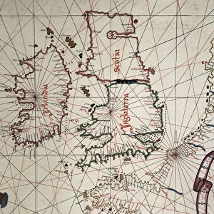
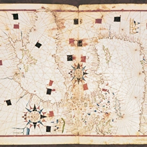
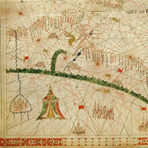
Jigsaw Puzzle : Portolan chart, 1587. Map of England, Scotland


![]()
Jigsaw Puzzles from Mary Evans Picture Library
Portolan chart, 1587. Map of England, Scotland
Portolan chart, 1587. Map of England, Scotland and Ireland with the north France coast. Realized in Messina. Facsimile. Renaissance art. Miniature Painting
Mary Evans Picture Library makes available wonderful images created for people to enjoy over the centuries
Media ID 8284275
© Mary Evans Picture Library 2015 - https://copyrighthub.org/s0/hub1/creation/maryevans/MaryEvansPictureID/10681998
Banner Banners Chart Facsimile Geographic Geographical Geography Illuminated Manuscript Manuscripts Messina Miniatures Portolan Renaissance Scot Land
Jigsaw Puzzle (500 Pieces)
Discover the captivating world of history with our Media Storehouse Jigsaw Puzzles, featuring the exquisite "Portolan Chart, 1587. Map of England, Scotland" by Rights Managed from Mary Evans Prints Online. This intricately detailed puzzle showcases a rare and fascinating piece of Renaissance art. Originating from Messina, this Portolan chart offers a glimpse into the cartography of the late 16th century, featuring the maps of England, Scotland, and Ireland, as well as the north French coast. Engage in a rewarding and educational experience as you piece together this stunning representation of a bygone era. Let the intrigue of history unfold before your eyes with our Media Storehouse Jigsaw Puzzles.
500 piece puzzles are custom made in Australia and hand-finished on 100% recycled 1.6mm thick laminated puzzle boards. There is a level of repetition in jigsaw shapes with each matching piece away from its pair. The completed puzzle measures 40x51cm and is delivered packaged in an attractive presentation box specially designed to fit most mail slots with a unique magnetic lid
Jigsaw Puzzles are an ideal gift for any occasion
Estimated Product Size is 40.3cm x 50.7cm (15.9" x 20")
These are individually made so all sizes are approximate
Artwork printed orientated as per the preview above, with landscape (horizontal) or portrait (vertical) orientation to match the source image.
MADE IN AUSTRALIA
Safe Shipping with 30 Day Money Back Guarantee
FREE PERSONALISATION*
We are proud to offer a range of customisation features including Personalised Captions, Color Filters and Picture Zoom Tools
SECURE PAYMENTS
We happily accept a wide range of payment options so you can pay for the things you need in the way that is most convenient for you
* Options may vary by product and licensing agreement. Zoomed Pictures can be adjusted in the Cart.