Home > North America > United States of America > New York > New York > Manhattan > Central Park
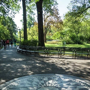
Plate 12, Part of Section 4: Bounded by W. 95th Street, Central Park West, W. 89th Street

![]()
Wall Art and Photo Gifts from Liszt Collection
Plate 12, Part of Section 4: Bounded by W. 95th Street, Central Park West, W. 89th Street
Plate 12, Part of Section 4: Bounded by W. 95th Street, Central Park West, W. 89th Street and Amsterdam Avenue
Liszt Collection of nineteenth-century engravings and images to browse and enjoy
Media ID 12672553
© Quint Lox Limited
Bounded By Cartographic Central Park West Historic Map Part Of Section 4 Plate 12 Vintage Map Old Map
FEATURES IN THESE COLLECTIONS
> North America
> United States of America
> Maps
> North America
> United States of America
> New York
> New York
> Manhattan
> Central Park
> North America
> United States of America
> New York
> New York
> Maps
> North America
> United States of America
> New York
> New York
> Sights
> Central Park
EDITORS COMMENTS
This vintage map, titled "Plate 12, Part of Section 4: Bounded by W. 95th Street, Central Park West, W. 89th Street and Amsterdam Avenue" is a captivating piece of cartographic history. The intricate details and precise craftsmanship transport us back to the bustling streets of New York City in times gone by. As we gaze upon this historic map from the Liszt Collection, we are reminded of the city's rich heritage and ever-evolving landscape. It offers a glimpse into the past with its depiction of old street names like W. 95th Street and Amsterdam Avenue – reminders that even amidst progress, remnants of history remain etched in our surroundings. The careful study of this cartographic gem reveals an America that once was - a testament to human ingenuity in mapping out urban spaces long before modern technology took over. Each line meticulously drawn represents not only physical boundaries but also stories waiting to be discovered. While it may be tempting to imagine ourselves wandering through these streets as they were decades ago, it is important to remember that this print serves as more than just decoration for our walls. It stands as a reminder that geography plays an integral role in shaping societies and cultures throughout time. Let us cherish this vintage map for what it truly represents – a tangible connection between past and present; an ode to the artistry behind cartography; and above all else, a gateway into understanding how our world has evolved over centuries.
MADE IN AUSTRALIA
Safe Shipping with 30 Day Money Back Guarantee
FREE PERSONALISATION*
We are proud to offer a range of customisation features including Personalised Captions, Color Filters and Picture Zoom Tools
SECURE PAYMENTS
We happily accept a wide range of payment options so you can pay for the things you need in the way that is most convenient for you
* Options may vary by product and licensing agreement. Zoomed Pictures can be adjusted in the Cart.