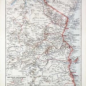
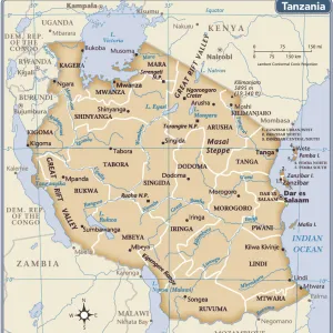
Mouse Mat : 1868, Dispatch, Weller Map of South Central Africa, Angola, Botswana, Tanzania, etc


![]()
Home Decor from Liszt Collection
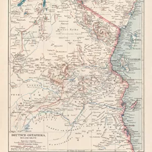
1868, Dispatch, Weller Map of South Central Africa, Angola, Botswana, Tanzania, etc
Liszt Collection of nineteenth-century engravings and images to browse and enjoy
Media ID 14006192
© Artokoloro Quint Lox Limited
1868 Angola Tanzania Antique Map Dispatch Latitude Longitude Mappa Mundi Old Antique Plan Old Antique View Ols Antique Map Rare Old Maps Topo
Mouse Pad
Bring some life into your office, or create a heartfelt gift, with a personalised deluxe Mouse Mat. Made of high-density black foam with a tough, stain-resistant inter-woven cloth cover they will brighten up any home or corporate office.
Archive quality photographic print in a durable wipe clean mouse mat with non slip backing. Works with all computer mice
Estimated Product Size is 24.2cm x 19.7cm (9.5" x 7.8")
These are individually made so all sizes are approximate
Artwork printed orientated as per the preview above, with landscape (horizontal) or portrait (vertical) orientation to match the source image.
EDITORS COMMENTS
This print showcases the remarkable 1868 Dispatch Weller Map of South Central Africa, offering a fascinating glimpse into the continent's historical geography. With its intricate details and exquisite artistry, this vintage map takes us on a journey through time, unraveling the mysteries of Angola, Botswana, Tanzania, and other neighboring regions. The map's topography is beautifully depicted, revealing the diverse landscapes that make up this part of Africa. Its cartographic precision allows us to explore latitude and longitude lines with ease while appreciating the geometric beauty of its design. As we delve into this ancient piece of history, we are transported back to an era when navigation relied heavily on paper maps like these. This decorative illustration not only serves as a valuable tool for travelers but also stands as a testament to our ancestors' thirst for discovery and exploration. It reminds us of how far we have come in understanding our world's vastness and complexity. As an antique relic from another time, this rare old map holds immense historical significance. Its aged appearance adds charm and character to any space it graces while serving as a reminder of the rich heritage that lies within our planet's borders. Whether you are an avid collector or simply appreciate the beauty found in historical artifacts like these, this print offers a unique opportunity to own a piece of history – one that tells stories untold and sparks curiosity about our ever-evolving world.
MADE IN AUSTRALIA
Safe Shipping with 30 Day Money Back Guarantee
FREE PERSONALISATION*
We are proud to offer a range of customisation features including Personalised Captions, Color Filters and Picture Zoom Tools
SECURE PAYMENTS
We happily accept a wide range of payment options so you can pay for the things you need in the way that is most convenient for you
* Options may vary by product and licensing agreement. Zoomed Pictures can be adjusted in the Cart.