Photographic Print > Europe > France > Canton > Landes
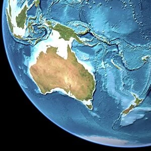
Photographic Print : Australia Circa 1760. From Atlas De Toutes Les Parties Connues Du Globe Terrestre By Cartographer Rigobert Bonne Published Geneva Circa 1760

![]()
Photo Prints from Design Pics
Australia Circa 1760. From Atlas De Toutes Les Parties Connues Du Globe Terrestre By Cartographer Rigobert Bonne Published Geneva Circa 1760
Design Pics offers Distinctively Different Imagery representing over 1,500 contributors
Media ID 18196278
© Ken Welsh / Design Pics
18th Australia Bonne Cartography Circa Eighteenth Guinea Holland Joined Land Making Tasmania Diemens
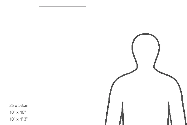
15"x10" (37.5x25cm) Poster
Step back in time with our exclusive Media Storehouse vintage photographic print of Australia, as depicted in Rigobert Bonne's 1760 map from the Atlas De Toutes Les Parties Connues Du Globe Terrestre. This beautiful, historically significant print by acclaimed photographer Ken Welsh transports you to an era of exploration and discovery. With meticulous attention to detail, this print captures the intricate cartography of the time, making it a captivating addition to any home or office space. Embrace the rich history of Australia with this stunning piece of art.
High-quality poster prints are available in a range of sizes and are printed on 270 gsm semi-glossy silk finish poster paper. An affordable option for decorating any space, they are perfect for fixing straight onto walls. To ensure your poster arrives in good condition, we roll and send them in strong mailing tubes.
Our Photo Prints are in a large range of sizes and are printed on Archival Quality Paper for excellent colour reproduction and longevity. They are ideal for framing (our Framed Prints use these) at a reasonable cost. Alternatives include cheaper Poster Prints and higher quality Fine Art Paper, the choice of which is largely dependant on your budget.
Estimated Product Size is 25cm x 37.5cm (9.8" x 14.8")
These are individually made so all sizes are approximate
Artwork printed orientated as per the preview above, with landscape (horizontal) or portrait (vertical) orientation to match the source image.
FEATURES IN THESE COLLECTIONS
> Europe
> France
> Canton
> Landes
> Maps and Charts
> Early Maps
> Maps and Charts
> Related Images
EDITORS COMMENTS
This print takes us back in time to Australia circa 1760, a period of exploration and discovery. From the renowned Atlas De Toutes Les Parties Connues Du Globe Terrestre by esteemed cartographer Rigobert Bonne, this map was published in Geneva during the same era. The intricate details on this historical piece showcase the vastness of New Holland (now known as Australia), Tasmania (then referred to as Van Diemen's Land), and Guinea. It offers a glimpse into the 18th century cartography techniques that were employed to create such remarkable maps. As we delve into this print, we are transported to an era where making maps was both an art form and a scientific pursuit. The meticulous joining of various regions demonstrates Bonne's dedication to accuracy and precision. Ken Welsh has expertly captured this significant piece of history through his lens, allowing us to appreciate its beauty and significance even today. This print serves as a reminder of our rich past, shedding light on how early explorers navigated uncharted territories with limited resources. Let this image transport you back in time, inviting you to explore the wonders of Australia from centuries ago. Immerse yourself in the world of cartography and discover how it shaped our understanding of geography throughout history.
MADE IN AUSTRALIA
Safe Shipping with 30 Day Money Back Guarantee
FREE PERSONALISATION*
We are proud to offer a range of customisation features including Personalised Captions, Color Filters and Picture Zoom Tools
SECURE PAYMENTS
We happily accept a wide range of payment options so you can pay for the things you need in the way that is most convenient for you
* Options may vary by product and licensing agreement. Zoomed Pictures can be adjusted in the Cart.