Photographic Print > Maps and Charts > World
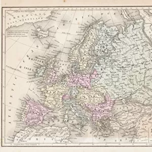
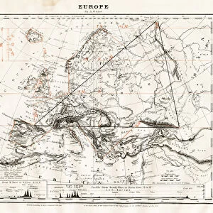
Photographic Print : Europe map 1898
![]()

Photo Prints from Fine Art Storehouse
Europe map 1898
Map from the Complete Handy Atlas of the World - 1898
Unleash your creativity and transform your space into a visual masterpiece!
THEPALMER
Media ID 19834477
© 2014 Roberto Adrian Photography
12"x8" (30x20cm) Photo Print
Step back in time with our exquisite European map print from ThePalmer's Complete Handy Atlas of the World, published in 1898. This captivating vintage map from Media Storehouse's Fine Art Storehouse collection transports you to an era of exploration and discovery. The intricate details of European borders, cities, and territories are brought to life in stunning, high-quality detail. Hang this historic map as a conversation starter, a decorative accent, or a tribute to the rich history of European cartography. Experience the past in a whole new way with our European map print from Media Storehouse.
Ideal for framing, Australian made Photo Prints are produced on high-quality 270 gsm lustre photo paper which has a subtle shimmer adding a touch of elegance, designed to enhance their visual appeal.
Our Photo Prints are in a large range of sizes and are printed on Archival Quality Paper for excellent colour reproduction and longevity. They are ideal for framing (our Framed Prints use these) at a reasonable cost. Alternatives include cheaper Poster Prints and higher quality Fine Art Paper, the choice of which is largely dependant on your budget.
Estimated Product Size is 31.4cm x 21.2cm (12.4" x 8.3")
These are individually made so all sizes are approximate
Artwork printed orientated as per the preview above, with landscape (horizontal) or portrait (vertical) orientation to match the source image.
FEATURES IN THESE COLLECTIONS
> Fine Art Storehouse
> Map
> Historical Maps
> Europe
> Related Images
> Maps and Charts
> Related Images
> Maps and Charts
> World
EDITORS COMMENTS
This print showcases a piece of history frozen in time - the Europe map from 1898. Taken from the renowned "Complete Handy Atlas of the World" this vintage treasure offers a window into an era long gone. With intricate details and exquisite craftsmanship, it transports us back to a time when cartography was both an art form and a means of exploration. The Europe map depicted here is not just any ordinary representation; it holds within its borders stories of empires rising and falling, cultures intertwining, and boundaries shifting. It serves as a visual testament to the rich tapestry that is European history. As we gaze upon this remarkable print by THEPALMER, we are reminded of how far we have come since those days. The world has evolved dramatically, yet there is something undeniably nostalgic about tracing our roots through such maps. Whether you're an avid historian or simply appreciate the beauty found in old-world charm, this print will undoubtedly captivate your imagination. Hang it proudly on your wall or gift it to someone with wanderlust in their heart - either way, let yourself be transported to a bygone era where explorers roamed these lands with curiosity and awe.
MADE IN AUSTRALIA
Safe Shipping with 30 Day Money Back Guarantee
FREE PERSONALISATION*
We are proud to offer a range of customisation features including Personalised Captions, Color Filters and Picture Zoom Tools
SECURE PAYMENTS
We happily accept a wide range of payment options so you can pay for the things you need in the way that is most convenient for you
* Options may vary by product and licensing agreement. Zoomed Pictures can be adjusted in the Cart.


