Home > Europe > France > Paris > Maps
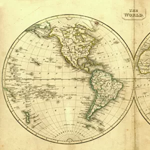
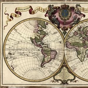
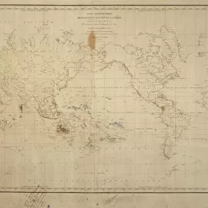
World map Drawn from Observations Made at the Academy of Sciences by Guillaume Delisle, by Claude-Auguste Berey, copperplate, printed in Paris, 1700

![]()
Wall Art and Photo Gifts from Universal Images Group (UIG)
World map Drawn from Observations Made at the Academy of Sciences by Guillaume Delisle, by Claude-Auguste Berey, copperplate, printed in Paris, 1700
Cartography, 18th century. World map drawn from observations made at the Academy of Sciences. Created by Guillaume Delisle, Paris, 1700. Copperplate by Claude-Auguste Berey. 49 x 77 cm
Universal Images Group (UIG) manages distribution for many leading specialist agencies worldwide
Media ID 9455201
© DEA PICTURE LIBRARY
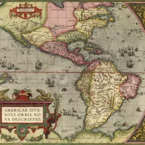
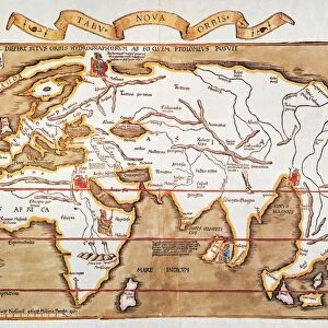
18th Century Africa Atlantic Ocean Background People Direction Guidance Indian Ocean Pacific Ocean South America Western Script World Map Eastern Hemisphere Guillaume Delisle Western Hemisphere
FEATURES IN THESE COLLECTIONS
> Africa
> Related Images
> Asia
> Related Images
> Europe
> France
> Paris
> Maps
> North America
> Related Images
> South America
> Related Images
> Universal Images Group (UIG)
> Art
> Painting, Sculpture & Prints
> Illustration And Painting
EDITORS COMMENTS
This print showcases a remarkable piece of cartography from the 18th century. Titled "World map Drawn from Observations Made at the Academy of Sciences by Guillaume Delisle" this masterpiece was created in Paris in 1700. The copperplate engraving, skillfully executed by Claude-Auguste Berey, measures an impressive 49 x 77 cm. The intricately detailed map provides a window into history, offering valuable insights into the geographical knowledge and understanding of that era. With its horizontal orientation, it spans across both hemispheres, depicting continents such as Africa, Asia, Europe, and North and South America. It also highlights major bodies of water including the Atlantic Ocean, Pacific Ocean, and Indian Ocean. Beyond its educational value lies an artistic charm that is evident in every stroke of ink on paper. The background people add depth to the illustration while Western script labels various regions with precision. As we gaze upon this extraordinary artwork today, it serves as a testament to human curiosity and exploration throughout time. A symbol of guidance for travelers then and now alike; it invites us to embark on our own journeys while reminding us of the vastness and interconnectedness of our world's physical geography
MADE IN AUSTRALIA
Safe Shipping with 30 Day Money Back Guarantee
FREE PERSONALISATION*
We are proud to offer a range of customisation features including Personalised Captions, Color Filters and Picture Zoom Tools
SECURE PAYMENTS
We happily accept a wide range of payment options so you can pay for the things you need in the way that is most convenient for you
* Options may vary by product and licensing agreement. Zoomed Pictures can be adjusted in the Cart.