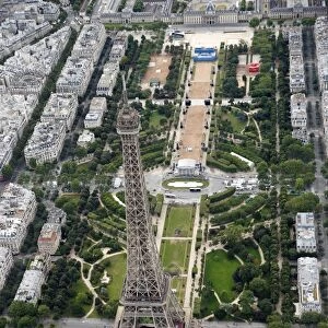
Home > Europe > France > Paris > Sights > Eiffel Tower
1900 Garnier Pocket Map Or Plan Of Paris France

![]()
Wall Art and Photo Gifts from Universal Images Group (UIG)
1900 Garnier Pocket Map Or Plan Of Paris France
1900, Garnier Pocket Map or Plan of Paris, France, Eiffel Tower and other Monuments
Universal Images Group (UIG) manages distribution for many leading specialist agencies worldwide
Media ID 38550060
© Artokoloro Quint Lox Limited
1900 Antique Map Latitude Longitude Mappa Mundi Old Antique Plan Old Antique View Ols Antique Map Rare Old Maps Topo
FEATURES IN THESE COLLECTIONS
> Architecture
> Towers
> Eiffel Tower
> Europe
> France
> Canton
> Landes
> Europe
> France
> Paris
> Maps
> Europe
> France
> Paris
> Related Images
> Europe
> France
> Paris
> Sights
> Eiffel Tower
> Europe
> France
> Paris
> Sights
> Related Images
> Historic
> Monuments and landmarks
> Monuments and memorials
> Historic
> Space exploration
> Maps and Charts
> Early Maps
> Universal Images Group (UIG)
> History
> Historical Maps
EDITORS COMMENTS
Step into the City of Light with this stunning 1900 Garnier Pocket Map Or Plan Of Paris, France. This vintage map is a treasure trove of geographical and historical significance, offering a unique glimpse into the capital city's layout and landmarks during the early 20th century.
The map showcases the iconic Eiffel Tower, which was still a relatively new addition to the Parisian skyline at that time. Other notable monuments and attractions are also depicted, including Notre-Dame Cathedral, the Louvre Museum, and the Arc de Triomphe. The intricate details on this map reveal a city in transformation, with new boulevards and avenues being built to accommodate its growing population.
This beautiful print is not only a fascinating piece of cartography but also an artful representation of urban planning and design. The ornate borders and typography add to its charm, making it a delightful addition to any room or collection.
Take a journey through time with this map as your guide. Let yourself be transported to an era when horse-drawn carriages rattled along cobblestone streets and street lamps cast their warm glow over charming cafes and bistros.
MADE IN AUSTRALIA
Safe Shipping with 30 Day Money Back Guarantee
FREE PERSONALISATION*
We are proud to offer a range of customisation features including Personalised Captions, Color Filters and Picture Zoom Tools
SECURE PAYMENTS
We happily accept a wide range of payment options so you can pay for the things you need in the way that is most convenient for you
* Options may vary by product and licensing agreement. Zoomed Pictures can be adjusted in the Cart.