Canvas Print > Europe > Italy > Emilia-Romagna > Modena
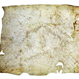
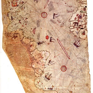
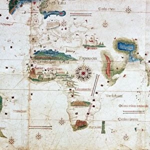
Canvas Print : The Cantino planisphere, 1502. Artist: Anonymous master


![]()
Canvas Prints from Heritage Images
The Cantino planisphere, 1502. Artist: Anonymous master
The Cantino planisphere, 1502. Found in the collection of the Biblioteca Estense Universitaria, Modena
Heritage Images features heritage image collections
Media ID 15015624
© Fine Art Images
Anonymous Master Cartography Chart Modena Nautical Chart Portolan Portolan Chart Portugal Watercolour On Parchment
21"x7" (53x18cm) Canvas Print
"Discover the mysteries of the ancient world with our exquisite Canvas Prints from Media Storehouse. This captivating piece showcases the enigmatic Cantino Planisphere, a rare and intriguing map from 1502. Originally found in the Biblioteca Estense Universitaria, Modena, this anonymous masterpiece has been meticulously reproduced in vibrant detail on high-quality canvas. Transport yourself back in time as the rich colors and textures bring the intricacies of this historical cartographic treasure to life in your home or office. Experience the mesmerizing allure of the Cantino Planisphere like never before with Media Storehouse's Canvas Prints."
Delivered stretched and ready to hang our premium quality canvas prints are made from a polyester/cotton blend canvas and stretched over a 1.25" (32mm) kiln dried knot free wood stretcher bar. Packaged in a plastic bag and secured to a cardboard insert for safe transit.
Canvas Prints add colour, depth and texture to any space. Professionally Stretched Canvas over a hidden Wooden Box Frame and Ready to Hang
Estimated Product Size is 53.3cm x 17.8cm (21" x 7")
These are individually made so all sizes are approximate
Artwork printed orientated as per the preview above, with landscape (horizontal) orientation to match the source image.
FEATURES IN THESE COLLECTIONS
> Europe
> Italy
> Emilia-Romagna
> Modena
> Europe
> Portugal
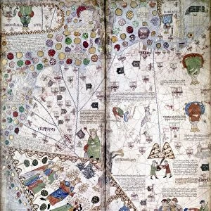
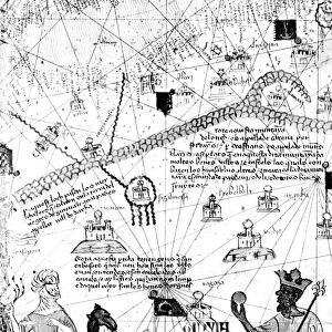
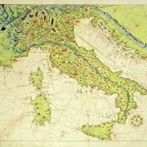
> Related Images
> Maps and Charts
> Related Images
EDITORS COMMENTS
This print showcases "The Cantino planisphere, 1502" a remarkable piece of cartographic artistry created by an anonymous master. The original map is currently housed in the esteemed collection of the Biblioteca Estense Universitaria in Modena. Crafted with intricate detail and precision, this portolan chart offers a fascinating glimpse into the world as it was known during the early 16th century. Painted delicately on parchment using watercolors, this fine example of graphic arts depicts various lands, seas, and coastlines meticulously mapped out for navigational purposes. The Cantino planisphere holds immense historical significance as one of the earliest surviving maps to showcase Portuguese discoveries during the Age of Exploration. It provides valuable insights into Portugal's maritime expansion and trade routes during that era. As you gaze upon this exquisite print, you can't help but marvel at how our understanding of geography has evolved over time. This map serves as a testament to human curiosity and determination to explore uncharted territories. Whether you are a history enthusiast or simply appreciate fine art images, this reproduction allows you to own a piece of nautical history. Displaying "The Cantino planisphere" in your home or office will undoubtedly spark conversations about ancient voyages and inspire dreams of embarking on new adventures across unexplored horizons.
MADE IN AUSTRALIA
Safe Shipping with 30 Day Money Back Guarantee
FREE PERSONALISATION*
We are proud to offer a range of customisation features including Personalised Captions, Color Filters and Picture Zoom Tools
SECURE PAYMENTS
We happily accept a wide range of payment options so you can pay for the things you need in the way that is most convenient for you
* Options may vary by product and licensing agreement. Zoomed Pictures can be adjusted in the Cart.