Home > Europe > Italy > Heritage Sites > City of Vicenza and the Palladian
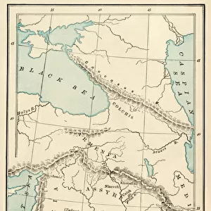
A Nautical Map, detail of the Gran Turco, 1564 (colour litho)
")
![]()
Wall Art and Photo Gifts from Fine Art Finder
A Nautical Map, detail of the Gran Turco, 1564 (colour litho)
955466 A Nautical Map, detail of the Gran Turco, 1564 (colour litho) by Maggiolo, Giacomo (16th Century); Biblioteca Civica Bertoliana, Vicenza, Italy; Alinari
Media ID 22244146
© Alinari / Bridgeman Images
Anatolia Armenia Cappadocia Cartographic Cartography Central Central Turkey Citadel Citadels Cities Coast Scenery Coastal Feature Coastl Compass Crowns Eastern Empires Ethiopia Galicia Gran Nautical Naval School Navigation Ruling Shipping Syria Topographical Turkish Culture Coast Scene Turco Turk
FEATURES IN THESE COLLECTIONS
> Africa
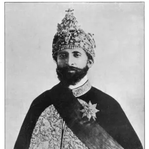
> Ethiopia (Abyssinia)
> Related Images
> Africa
> Ethiopia
> Related Images
> Arts
> Artists
> Related Images
> Asia
> Turkey
> Related Images
> Europe
> Italy
> Heritage Sites
> City of Vicenza and the Palladian
> Europe
> Italy
> Veneto
> Vicenza
> Fine Art Finder
> Artists
> Giacomo Maggiolo
> Fine Art Finder
> Artists
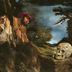
> Guercino (1591-1666)
> Fine Art Finder
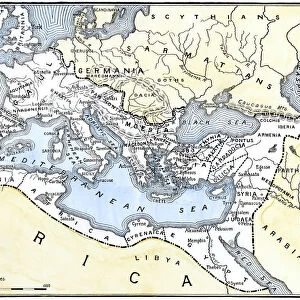
> Maps (celestial & Terrestrial)
EDITORS COMMENTS
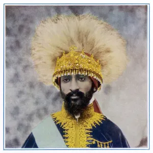
This print showcases a stunning detail of the Gran Turco, a nautical map created in 1564 by Giacomo Maggiolo. The vibrant colors and intricate details bring this historical piece to life, allowing us to delve into the world of cartography during the Renaissance era. The map depicts various elements that highlight the power and influence of empires during that time. From majestic ships sailing across the Black Sea to fortified cities with towering citadels, every aspect tells a story of medieval ruling and naval dominance. The compass symbolizes navigation prowess while crowns represent authority and sovereignty. As our eyes wander through this masterpiece, we are transported from Italy's coastline to Cappadocia in central Turkey, exploring regions like Armenia, Syria, Ethiopia, and Anatolia along the way. This detailed topographical representation not only serves as an invaluable tool for sailors but also offers insights into cultural exchanges between Europe and Asia. The presence of Turkish culture is evident throughout the map - from turban-wearing figures representing troops or armed forces to symbols depicting Middle Eastern architecture. It serves as a testament to the rich heritage found in Central Turkey and its significance within European history. Overall, this print captures both artistic beauty and historical importance. It allows us to appreciate how maps were not just utilitarian objects but also works of art that reflected political landscapes and cultural connections between different regions of the world.
MADE IN AUSTRALIA
Safe Shipping with 30 Day Money Back Guarantee
FREE PERSONALISATION*
We are proud to offer a range of customisation features including Personalised Captions, Color Filters and Picture Zoom Tools
SECURE PAYMENTS
We happily accept a wide range of payment options so you can pay for the things you need in the way that is most convenient for you
* Options may vary by product and licensing agreement. Zoomed Pictures can be adjusted in the Cart.