Fraud Blocker Skip to main content

Home > Fine Art Finder > Maps (celestial & Terrestrial)

Maps (celestial & Terrestrial) Collection (page 3)

1,542 items

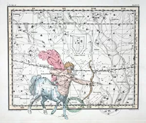
Background imageMaps (celestial & Terrestrial) Collection: The Constellations (Plate XX) Sagittarius, from A Celestial Atlas

The Constellations (Plate XX) Sagittarius, from A Celestial Atlas
956769 The Constellations (Plate XX) Sagittarius, from A Celestial Atlas by Alexander Jamieson, pub. London 1822 (hand coloured engraving) by Jamieson

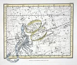
Background imageMaps (celestial & Terrestrial) Collection: The Constellations (Plate XIX) Libra and Scorpio, from A Celestial Atlas

The Constellations (Plate XIX) Libra and Scorpio, from A Celestial Atlas
956768 The Constellations (Plate XIX) Libra and Scorpio, from A Celestial Atlas by Alexander Jamieson, pub. London 1822 (hand coloured engraving) by Jamieson

Background imageMaps (celestial & Terrestrial) Collection: The Constellations (Plate XVI) Cancer, from A Celestial Atlas

The Constellations (Plate XVI) Cancer, from A Celestial Atlas
956766 The Constellations (Plate XVI) Cancer, from A Celestial Atlas by Alexander Jamieson, pub. London 1822 (hand coloured engraving) by Jamieson

Background imageMaps (celestial & Terrestrial) Collection: The Moon, Venus and Saturn (Plate XXX), from A Celestial Atlas

The Moon, Venus and Saturn (Plate XXX), from A Celestial Atlas
956782 The Moon, Venus and Saturn (Plate XXX), from A Celestial Atlas by Alexander Jamieson, pub. London 1822 (hand coloured engraving) by Jamieson

Background imageMaps (celestial & Terrestrial) Collection: The Constellations (Plate XI) Cygnus, Lacerta and Via Lactea

The Constellations (Plate XI) Cygnus, Lacerta and Via Lactea
956776 The Constellations (Plate XI) Cygnus, Lacerta and Via Lactea, from A Celestial Atlas by Alexander Jamieson, pub. London 1822 (hand coloured engraving) by Jamieson

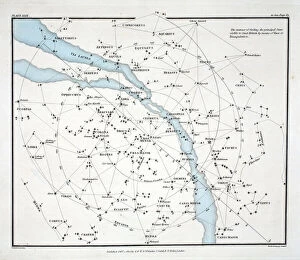
Background imageMaps (celestial & Terrestrial) Collection: Map showing the principal stars which are visible in Great Britain (Plate (XXIX)

Map showing the principal stars which are visible in Great Britain (Plate (XXIX)
956775 Map showing the principal stars which are visible in Great Britain (Plate (XXIX), from A Celestial Atlas by Alexander Jamieson, pub

Background imageMaps (celestial & Terrestrial) Collection: The Constellations (Plate XXVII) Hydra Continua, Crater, Covus, Centaurus et Lupus

The Constellations (Plate XXVII) Hydra Continua, Crater, Covus, Centaurus et Lupus
956774 The Constellations (Plate XXVII) Hydra Continua, Crater, Covus, Centaurus et Lupus, from A Celestial Atlas by Alexander Jamieson, pub

Background imageMaps (celestial & Terrestrial) Collection: The Constellations (Plate XVII) Leo, from A Celestial Atlas

The Constellations (Plate XVII) Leo, from A Celestial Atlas
956767 The Constellations (Plate XVII) Leo, from A Celestial Atlas by Alexander Jamieson, pub. London 1822 (hand coloured engraving) by Jamieson

Background imageMaps (celestial & Terrestrial) Collection: The Constellations (Plate XV) Gemini, from A Celestial Atlas

The Constellations (Plate XV) Gemini, from A Celestial Atlas
956765 The Constellations (Plate XV) Gemini, from A Celestial Atlas by Alexander Jamieson, pub. London 1822 (hand coloured engraving) by Jamieson

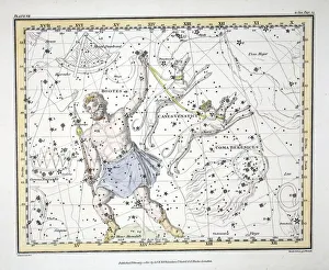
Background imageMaps (celestial & Terrestrial) Collection: The Constellations (Plate VII) Bootes and Mons Maenalus

The Constellations (Plate VII) Bootes and Mons Maenalus
956760 The Constellations (Plate VII) Bootes and Mons Maenalus, Asterion and Chara or Canes Venatici, Coma Berenices, , from A Celestial Atlas by Alexander Jamieson, pub

Background imageMaps (celestial & Terrestrial) Collection: Ancient Hemispheres of the World, plate 94 from The Celestial Atlas

Ancient Hemispheres of the World, plate 94 from The Celestial Atlas
STC90199 Ancient Hemispheres of the World, plate 94 from The Celestial Atlas, or the Harmony of the Universe (Atlas coelestis seu harmonia macrocosmica) pub

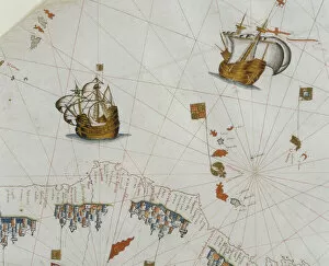
Background imageMaps (celestial & Terrestrial) Collection: A Nautical Map, detail of the Canary Islands, 1564 (colour litho)

A Nautical Map, detail of the Canary Islands, 1564 (colour litho)
955467 A Nautical Map, detail of the Canary Islands, 1564 (colour litho) by Maggiolo, Giacomo (16th Century); Biblioteca Civica Bertoliana, Vicenza, Italy; Alinari

Background imageMaps (celestial & Terrestrial) Collection: A Nautical Map, detail of Western Europe, 1564 (colour litho)

A Nautical Map, detail of Western Europe, 1564 (colour litho)
955465 A Nautical Map, detail of Western Europe, 1564 (colour litho) by Maggiolo, Giacomo (16th Century); Biblioteca Civica Bertoliana, Vicenza, Italy; Alinari

Background imageMaps (celestial & Terrestrial) Collection: The Region of Verona with the District of Cologna, 1783 (hand-coloured etching)

The Region of Verona with the District of Cologna, 1783 (hand-coloured etching)
1067374 The Region of Verona with the District of Cologna, 1783 (hand-coloured etching) by Zatta, Antonio (1757-97); Dallas Museum of Art, Texas

Background imageMaps (celestial & Terrestrial) Collection: Map of Tuscany, detail of the large map of J. de Baillou (pencil, ink & w / c on paper)

Map of Tuscany, detail of the large map of J. de Baillou (pencil, ink & w / c on paper)
1077765 Map of Tuscany, detail of the large map of J. de Baillou (pencil, ink & w/c on paper) by French School, (19th century); BibliothAque Paul-Marmottan, Ville de Boulogne-Billancourt

Background imageMaps (celestial & Terrestrial) Collection: Map of the town of Florence, 1812 (pencil, ink & w / c on paper)

Map of the town of Florence, 1812 (pencil, ink & w / c on paper)
1077759 Map of the town of Florence, 1812 (pencil, ink & w/c on paper) by French School, (19th century); BibliothAque Paul-Marmottan, Ville de Boulogne-Billancourt, Academie des Beaux-Arts

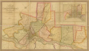
Background imageMaps (celestial & Terrestrial) Collection: A Map of the County of Philadelphia, from Actual Survey, 1843 (colour litho)

A Map of the County of Philadelphia, from Actual Survey, 1843 (colour litho)
1121423 A Map of the County of Philadelphia, from Actual Survey, 1843 (colour litho) by American School, (19th century); Free Library of Philadelphia; (add.info)

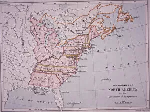
Background imageMaps (celestial & Terrestrial) Collection: The Colonies of North America at the Declaration of Independence (colour litho)

The Colonies of North America at the Declaration of Independence (colour litho)
PNP468338 The Colonies of North America at the Declaration of Independence (colour litho) by Stanford, Edward (1827-1904); Private Collection; (add.info)

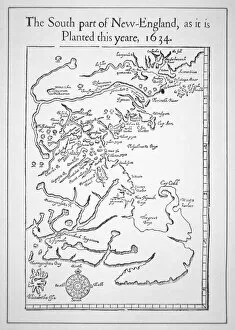
Background imageMaps (celestial & Terrestrial) Collection: Map including Massachusetts Bay (litho)

Map including Massachusetts Bay (litho)
PNP367770 Map including Massachusetts Bay (litho) by American School; Private Collection; (add.info.: the south part of New-England as it is planted this yeare)

Background imageMaps (celestial & Terrestrial) Collection: Maps of the moon, illustration from Sidereus Nuncius by Galileo Galilei

Maps of the moon, illustration from Sidereus Nuncius by Galileo Galilei
CHT382344 Maps of the moon, illustration from Sidereus Nuncius by Galileo Galilei, 1610 (engraving) by Italian School, (17th century); Bibliotheque Nationale, Paris

Background imageMaps (celestial & Terrestrial) Collection: Map of Mexico or New Spain, 1625 (coloured engraving)

Map of Mexico or New Spain, 1625 (coloured engraving)
REV397909 Map of Mexico or New Spain, 1625 (coloured engraving) by French School, (17th century); Biblioteca Nacional de Mexico

Background imageMaps (celestial & Terrestrial) Collection: Map showing the military campaigns of Louis XIV in the Low Countries

Map showing the military campaigns of Louis XIV in the Low Countries
741366 Map showing the military campaigns of Louis XIV in the Low Countries, from Atlas geographique et militaire, published in Paris, 1763 (colour engraving) by Rizzi-Zannoni

Background imageMaps (celestial & Terrestrial) Collection: Map of Africa, in the Sala del Mappamondo (fresco)

Map of Africa, in the Sala del Mappamondo (fresco)
808748 Map of Africa, in the Sala del Mappamondo (fresco) by Varese, Antonio Giovanni de (16th century); Villa Farnese, Caprarola, Voterbo, Lazio, Italy; Italian, out of copyright

Background imageMaps (celestial & Terrestrial) Collection: Map of the Siege of Mantua, published by William Blackwood and Sons, Edinburgh & London

Map of the Siege of Mantua, published by William Blackwood and Sons, Edinburgh & London
746934 Map of the Siege of Mantua, published by William Blackwood and Sons, Edinburgh & London, 1848 (hand-coloured engraving) by Johnston

Background imageMaps (celestial & Terrestrial) Collection: Map of the Heilsberg, published by William Blackwood and Sons, Edinburgh & London

Map of the Heilsberg, published by William Blackwood and Sons, Edinburgh & London
746906 Map of the Heilsberg, published by William Blackwood and Sons, Edinburgh & London, 1848 (hand-coloured engraving) by Johnston

Background imageMaps (celestial & Terrestrial) Collection: Map of the Battle of Aspern or Essling, published by William Blackwood and Sons

Map of the Battle of Aspern or Essling, published by William Blackwood and Sons
746902 Map of the Battle of Aspern or Essling, published by William Blackwood and Sons, Edinburgh & London, 1848 (hand-coloured engraving) by Johnston

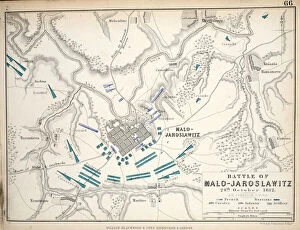
Background imageMaps (celestial & Terrestrial) Collection: Map of the Battle of Malo-Jaroslawitz, published by William Blackwood and Sons

Map of the Battle of Malo-Jaroslawitz, published by William Blackwood and Sons
746892 Map of the Battle of Malo-Jaroslawitz, published by William Blackwood and Sons, Edinburgh & London, 1848 (hand-coloured engraving) by Johnston

Background imageMaps (celestial & Terrestrial) Collection: Map of the Battle of Hanau, published by William Blackwood and Sons, Edinburgh & London

Map of the Battle of Hanau, published by William Blackwood and Sons, Edinburgh & London
746884 Map of the Battle of Hanau, published by William Blackwood and Sons, Edinburgh & London, 1848 (hand-coloured engraving) by Johnston

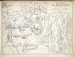
Background imageMaps (celestial & Terrestrial) Collection: Map of the Battle of La Rothiere, published by William Blackwood and Sons, Edinburgh & London

Map of the Battle of La Rothiere, published by William Blackwood and Sons, Edinburgh & London
746883 Map of the Battle of La Rothiere, published by William Blackwood and Sons, Edinburgh & London, 1848 (hand-coloured engraving) by Johnston

Background imageMaps (celestial & Terrestrial) Collection: Map of the Battle of Fleurus, published by William Blackwood and Sons, Edinburgh & London

Map of the Battle of Fleurus, published by William Blackwood and Sons, Edinburgh & London
746876 Map of the Battle of Fleurus, published by William Blackwood and Sons, Edinburgh & London, 1848 (hand-coloured engraving) by Johnston

Background imageMaps (celestial & Terrestrial) Collection: Map of the Siege of Toulon, published by William Blackwood and Sons, Edinburgh & London

Map of the Siege of Toulon, published by William Blackwood and Sons, Edinburgh & London
746872 Map of the Siege of Toulon, published by William Blackwood and Sons, Edinburgh & London, 1848 (hand-coloured engraving) by Johnston

Background imageMaps (celestial & Terrestrial) Collection: Map of the Battle of Cape St. Vincent, published by William Blackwood and Sons

Map of the Battle of Cape St. Vincent, published by William Blackwood and Sons
746931 Map of the Battle of Cape St. Vincent, published by William Blackwood and Sons, Edinburgh & London, 1848 (hand-coloured engraving) by Johnston

Background imageMaps (celestial & Terrestrial) Collection: Map of the Battle of Stockach, published by William Blackwood and Sons

Map of the Battle of Stockach, published by William Blackwood and Sons
746926 Map of the Battle of Stockach, published by William Blackwood and Sons, Edinburgh & London, 1848 (hand-coloured engraving) by Johnston

Background imageMaps (celestial & Terrestrial) Collection: Map of the Battle of Hohenlinden, published by William Blackwood and Sons

Map of the Battle of Hohenlinden, published by William Blackwood and Sons
746919 Map of the Battle of Hohenlinden, published by William Blackwood and Sons, Edinburgh & London, 1848 (hand-coloured engraving) by Johnston

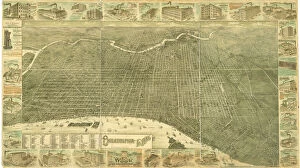
Background imageMaps (celestial & Terrestrial) Collection: Philadelphia in 1886 (colour litho)

Philadelphia in 1886 (colour litho)
483714 Philadelphia in 1886 (colour litho) by Burk, William, and McFetridge, John (fl.1886); 104x183 cm; Free Library of Philadelphia; eFree Library of Philadelphia; Map Collection

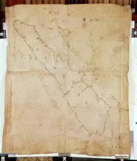
Background imageMaps (celestial & Terrestrial) Collection: Ms 1288 Chart of Sumatra, 1653 (pen, ink & wash on paper)

Ms 1288 Chart of Sumatra, 1653 (pen, ink & wash on paper)
BIF391162 Ms 1288 Chart of Sumatra, 1653 (pen, ink & wash on paper) by Blaeu, Joan (1596-1673); Bibliotheque de l Institut de France, Paris, France; Dutch, out of copyright

Background imageMaps (celestial & Terrestrial) Collection: Map of France, c. 1914 (colour litho)

Map of France, c. 1914 (colour litho)
CHT391149 Map of France, c. 1914 (colour litho) by French School, (20th century); Private Collection; (add.info.: map shows the French Departments before the 1st World War with Alsace-Lorraine)

Background imageMaps (celestial & Terrestrial) Collection: SYSTEME SOLAIRE (no. 1), from Tableaux du Systeme Planetaire, pub

SYSTEME SOLAIRE (no. 1), from Tableaux du Systeme Planetaire, pub
2655279 SYSToME SOLAIRE (no. 1), from Tableaux du Systeme Planetaire, pub. Paris, 1839 (stipple engraving) by Visconti, Sigismond (fl.1839) (after); 51x49 cm; Private Collection; (add.info)

Background imageMaps (celestial & Terrestrial) Collection: Phases de la Lune (no. 4), from Tableaux du Systeme Planetaire, pub

Phases de la Lune (no. 4), from Tableaux du Systeme Planetaire, pub
2655278 Phases de la Lune (no. 4), from Tableaux du Systeme Planetaire, pub. Paris, 1839 (stipple engraving) by Visconti, Sigismond (fl.1839) (after); 51x49 cm; Private Collection; (add.info)

Background imageMaps (celestial & Terrestrial) Collection: Map depicting The Invasions of England and Ireland With al [sic] their Civill [sic]

Map depicting The Invasions of England and Ireland With al [sic] their Civill [sic]
2973855 Map depicting The Invasions of England and Ireland With al [sic] their Civill [sic] Wars since the Conquest, c.1627 (hand-coloured engraving) by Speed, John (1552-1629); National Army Museum

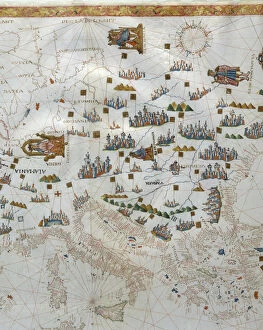
Background imageMaps (celestial & Terrestrial) Collection: Holy Roman Emperor, detail from a Renaissance map of Europe, Jacopo Russo

Holy Roman Emperor, detail from a Renaissance map of Europe, Jacopo Russo
2910987 Holy Roman Emperor, detail from a Renaissance map of Europe, Jacopo Russo by Russo, Jacopo (15th century); (add.info.: Renaissance map of Europe, Jacopo Russo, 1528)

Background imageMaps (celestial & Terrestrial) Collection: Compass point, Renaissance map of Europe, Jacopo Russo (after) 1528

Compass point, Renaissance map of Europe, Jacopo Russo (after) 1528
2910975 Compass point, Renaissance map of Europe, Jacopo Russo (after) 1528 by Russo, Jacopo (15th century); (add.info.: Renaissance map of Europe, Jacopo Russo, 1528)

Background imageMaps (celestial & Terrestrial) Collection: Egypt and the Red Sea detail from a Renaissance map of Europe, Jacopo Russo (after) 1528

Egypt and the Red Sea detail from a Renaissance map of Europe, Jacopo Russo (after) 1528
2910969 Egypt and the Red Sea detail from a Renaissance map of Europe, Jacopo Russo (after) 1528 by Russo, Jacopo (15th century); (add.info.: Renaissance map of Europe, Jacopo Russo, 1528, detail)

Background imageMaps (celestial & Terrestrial) Collection: Elsinore, Denmark, from Civitates Orbis Terrarum

Elsinore, Denmark, from Civitates Orbis Terrarum
2901810 Elsinore, Denmark, from Civitates Orbis Terrarum by Georg Braun (1541-1622) and Frans Hogenburg (1535-90), c.1572 (coloured engraving) by Hoefnagel

Background imageMaps (celestial & Terrestrial) Collection: Detail of Tower of London, from Civitas Londinum, map of London

Detail of Tower of London, from Civitas Londinum, map of London
2906802 Detail of Tower of London, from Civitas Londinum, map of London, 1560 (woodblock print) by Agas, Ralph (c.1540-1621); London Metropolitan Archives

Background imageMaps (celestial & Terrestrial) Collection: Two Hemispheres of the Earth Facing Each Other, 1959 (colour litho)

Two Hemispheres of the Earth Facing Each Other, 1959 (colour litho)
2630055 Two Hemispheres of the Earth Facing Each Other, 1959 (colour litho) by American School, (20th century); Private Collection; Photo eGraphicaArtis; American, out of copyright

Background imageMaps (celestial & Terrestrial) Collection: Praehagraphy of England, being a map of that Kingdom illustrative of the principle

Praehagraphy of England, being a map of that Kingdom illustrative of the principle
3062960 Praehagraphy of England, being a map of that Kingdom illustrative of the principle battles fought in it, 1807 (engraving) by English School, (19th century); National Army Museum

Background imageMaps (celestial & Terrestrial) Collection: Bacons Large-Scale Map of the Transvaal Orange Free State

Bacons Large-Scale Map of the Transvaal Orange Free State
3062953 Bacons Large-Scale Map of the Transvaal Orange Free State and Natal with extension south to Port Elizabeth, South Africa, 1900 (coloured engraving) by English School


All Professionally Made to Order for Quick Shipping


-

Why Choose Us?

We are a leading provider of Art Prints and Photo Gifts since 2003, working in partnership with a range of Sporting Clubs, Charities, Museums and Picture Libraries. A large share of profits from any of their images will go directly towards supporting that charity or club. Our archive of images is carefully curated to bring you a wide range of subjects, including landscapes, wildlife, architecture, and more. We ship from our partner labs in the UK, USA, EU (Netherlands) and Australia.
+

How do I place an order?

Ordering is quick & easy - Just follow 5 Simple Steps:
  1. Find your image: Use our search box or browse our online photo Collections to find the image you want.

  2. Choose your print format: Select your desired product and add it to your cart.

  3. Enter your details: If you're a returning customer, simply enter your email address and password, and we'll fill in your billing and shipping address details. All personal details are held securely and are fully GDPR compliant. As standard, we remove all Personally Identifiable Information after 12 months.

  4. Pay for your purchase: We use state-of-the-art security for online shopping and do not have access to your card details.

  5. Sit back and relax: We'll email you confirmation of your order and when it's dispatched. Registered customers can also track orders in the 'My Account' area.

+

How do I pay for an order?

You can pay for your order with most of the major credit and debit cards, or PayPal. For added security, major financial institutions process payment details separately and securely on our behalf. We do not have access to your online payment card details. Online payments are preferred however we do take phone orders. For UK customers only we accept cheques issued against a UK bank.
+

Is my data safe?

We take data security very seriously. We do not have access to your full card details and all payments are requested over a fully secure connection. Additionally, we fully comply with current European and GDPR legislation, and automatically remove all personal data after at most 12 months (unless you have an account with us and have signed in recently). We also have a strict opt-in policy and would never sell your personal details. Your data is only used to fulfill your order promptly and efficiently.
+

Is wall art ready to hang?

For quick and easy installation all wall art, including framed prints, canvas prints and metal prints are supplied with a ready to hang solution on the back. Generally, saw tooth hangers are applied as they allow wall art to hang flush against the wall. The serrated edge of the hanger prevents the frame from shifting or tilting when hung.
+

Are the photo prints fade resistant?

Yes, we use archival quality photo paper photographic paper for vivid reproduction Prints are an accurate representations of the original artwork, which is preserved for artistic character and authenticity. We guarantee they match previews shown on our web site