Fraud Blocker Skip to main content

Home > Fine Art Finder > Maps (celestial & Terrestrial)

Maps (celestial & Terrestrial) Collection (page 9)

1,542 items

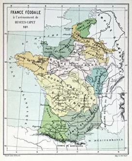
Background imageMaps (celestial & Terrestrial) Collection: Feudal France at the time of the Accession of Hugues Capet in 987

Feudal France at the time of the Accession of Hugues Capet in 987
CHT277038 Feudal France at the time of the Accession of Hugues Capet in 987, map illustrated in a Histoire de France c.1880 (colour litho) by French School

Background imageMaps (celestial & Terrestrial) Collection: Map of Basel (engraving) (b / w photo)

Map of Basel (engraving) (b / w photo)
CHT224856 Map of Basel (engraving) (b/w photo) by Swiss School, (16th century); Bibliotheque des Arts Decoratifs, Paris, France; eArchives Charmet; Swiss, out of copyright

Background imageMaps (celestial & Terrestrial) Collection: Map depicting the East Coast of North America, 1647 (colour litho) (see 93602 and 216517)

Map depicting the East Coast of North America, 1647 (colour litho) (see 93602 and 216517)
CHT216518 Map depicting the East Coast of North America, 1647 (colour litho) (see 93602 and 216517) by Blaeu, Joan (1596-1673); Private Collection; (add.info.: map shows New Amsterdam)

Background imageMaps (celestial & Terrestrial) Collection: Britain As It Was Devided In The Tyme of the Englishe Saxons, 1616 (colour engraving)

Britain As It Was Devided In The Tyme of the Englishe Saxons, 1616 (colour engraving)
STC217006 Britain As It Was Devided In The Tyme of the Englishe Saxons, 1616 (colour engraving) by Speed, John (1552-1629); Private Collection; (add.info)

Background imageMaps (celestial & Terrestrial) Collection: Plan of London from Civitates Orbis Terrarum, vol

Plan of London from Civitates Orbis Terrarum, vol
UCL273925 Plan of London from Civitates Orbis Terrarum, vol. 1, 1572 (coloured engraving on paper) by Hogenberg, Franz (1540-c.1590); 39.6x53.0 cm; UCL Art Museum, University College London

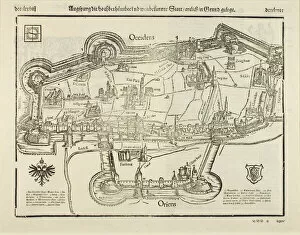
Background imageMaps (celestial & Terrestrial) Collection: Plan of Augsburg, from Cosmographia, 1544 (woodcut on paper)

Plan of Augsburg, from Cosmographia, 1544 (woodcut on paper)
UCL273924 Plan of Augsburg, from Cosmographia, 1544 (woodcut on paper) by Munster, Sebastian (1589-1552); 34.4x40.3 cm; UCL Art Museum, University College London, UK; eUCL Art Museum

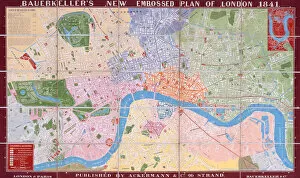
Background imageMaps (celestial & Terrestrial) Collection: Bauerkellers New, Embossed, Plan of London, 1841 (colour lithograph)

Bauerkellers New, Embossed, Plan of London, 1841 (colour lithograph)
STC255320 Bauerkellers New, Embossed, Plan of London, 1841 (colour lithograph) by Bauerkeller, George (fl.1841); Private Collection; The Stapleton Collection; English, out of copyright

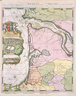
Background imageMaps (celestial & Terrestrial) Collection: La Naptune Francois, ou Atlas des Cartes Marines, 1693 (colour litho)

La Naptune Francois, ou Atlas des Cartes Marines, 1693 (colour litho)
STC255319 La Naptune Francois, ou Atlas des Cartes Marines, 1693 (colour litho) by Mortier, Pierre (Pieter) (1661-1711); Private Collection; The Stapleton Collection; French, out of copyright

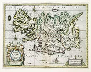
Background imageMaps (celestial & Terrestrial) Collection: Map of Iceland (colour engraving)

Map of Iceland (colour engraving)
STC255317 Map of Iceland (colour engraving) by Blaeu, Willem (1571-1638); Private Collection; The Stapleton Collection; Dutch, out of copyright

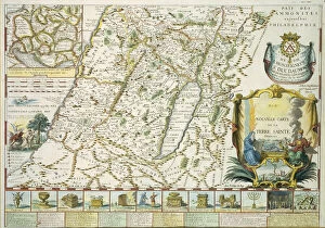
Background imageMaps (celestial & Terrestrial) Collection: Map of the Holy land in Old Testament times by Mons l Abbe de la Grive

Map of the Holy land in Old Testament times by Mons l Abbe de la Grive
STC255316 Map of the Holy land in Old Testament times by Mons l Abbe de la Grive, 1772 (coloured engraving) by French School, (18th century); Private Collection; The Stapleton Collection; French

Background imageMaps (celestial & Terrestrial) Collection: Pair of 12-inch celestial and territorial globes (mixed media)

Pair of 12-inch celestial and territorial globes (mixed media)
MFR348320 Pair of 12-inch celestial and territorial globes (mixed media) by Blaeu, Willem (1571-1638); 30.48 cm; Private Collection; Dutch, out of copyright

Background imageMaps (celestial & Terrestrial) Collection: Ile Ste. Croix, the earliest French Settlement in Acadia, 1604

Ile Ste. Croix, the earliest French Settlement in Acadia, 1604
STC347509 Ile Ste. Croix, the earliest French Settlement in Acadia, 1604, from Voyages by Samuel de Champlain (c.1580-1635), 1613 (engraving) by French School

Background imageMaps (celestial & Terrestrial) Collection: Map of Rovigo, from Les Villes de Venetie, 1704

Map of Rovigo, from Les Villes de Venetie, 1704
REV345835 Map of Rovigo, from Les Villes de Venetie, 1704, published by Pierre Mortier in Amsterdam (engraving) by Mortier

Background imageMaps (celestial & Terrestrial) Collection: Map of Verona, from Les Villes de Venetie, 1704

Map of Verona, from Les Villes de Venetie, 1704
REV345808 Map of Verona, from Les Villes de Venetie, 1704, published by Pierre Mortier in Amsterdam (engraving) by Mortier

Background imageMaps (celestial & Terrestrial) Collection: Map of South America, published in 1700, Paris (colour engraving)

Map of South America, published in 1700, Paris (colour engraving)
REV345803 Map of South America, published in 1700, Paris (colour engraving) by Delisle, Guillaume (1675-1726) (after); Private Collection; (add.info.: Guillaume de L Isle)

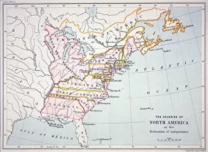
Background imageMaps (celestial & Terrestrial) Collection: Map of the Colonies of North America at the time of the Declaration of Independence

Map of the Colonies of North America at the time of the Declaration of Independence
PNP316579 Map of the Colonies of North America at the time of the Declaration of Independence (colour engraving) by American School; Private Collection; (add.info)

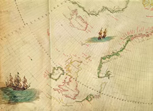
Background imageMaps (celestial & Terrestrial) Collection: Ms. 1288 fol. 1 The Polar Aurora, detail of England, Ireland and Norway

Ms. 1288 fol. 1 The Polar Aurora, detail of England, Ireland and Norway
BIF271727 Ms. 1288 fol. 1 The Polar Aurora, detail of England, Ireland and Norway, from a Collection of Dutch Marine Maps (engraving) by Gerritsz

Background imageMaps (celestial & Terrestrial) Collection: Map of the Battle of Novi, published by William Blackwood and Sons, Edinburgh & London

Map of the Battle of Novi, published by William Blackwood and Sons, Edinburgh & London
746923 Map of the Battle of Novi, published by William Blackwood and Sons, Edinburgh & London, 1848 (hand-coloured engraving) by Johnston

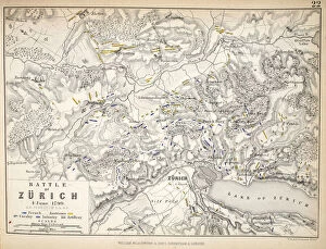
Background imageMaps (celestial & Terrestrial) Collection: Map of the Battle of Zurich, published by William Blackwood and Sons, Edinburgh & London

Map of the Battle of Zurich, published by William Blackwood and Sons, Edinburgh & London
746922 Map of the Battle of Zurich, published by William Blackwood and Sons, Edinburgh & London, 1848 (hand-coloured engraving) by Johnston

Background imageMaps (celestial & Terrestrial) Collection: Map of the Operations which led to the Capitulation of Ulm

Map of the Operations which led to the Capitulation of Ulm
746914 Map of the Operations which led to the Capitulation of Ulm, published by William Blackwood and Sons, Edinburgh & London, 1848 (hand-coloured engraving) by Johnston

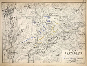
Background imageMaps (celestial & Terrestrial) Collection: Map of the Battle of Austerlitz, published by William Blackwood and Sons

Map of the Battle of Austerlitz, published by William Blackwood and Sons
746911 Map of the Battle of Austerlitz, published by William Blackwood and Sons, Edinburgh & London, 1848 (hand-coloured engraving) by Johnston

Background imageMaps (celestial & Terrestrial) Collection: Map of the Battle of Aspern or Essling, published by William Blackwood and Sons

Map of the Battle of Aspern or Essling, published by William Blackwood and Sons
746901 Map of the Battle of Aspern or Essling, published by William Blackwood and Sons, Edinburgh & London, 1848 (hand-coloured engraving) by Johnston

Background imageMaps (celestial & Terrestrial) Collection: Map of the Battle of Ocana, published by William Blackwood and Sons, Edinburgh & London

Map of the Battle of Ocana, published by William Blackwood and Sons, Edinburgh & London
746897 Map of the Battle of Ocana, published by William Blackwood and Sons, Edinburgh & London, 1848 (hand-coloured engraving) by Johnston

Background imageMaps (celestial & Terrestrial) Collection: Map of the Siege of St Sebastian, published by William Blackwood and Sons

Map of the Siege of St Sebastian, published by William Blackwood and Sons
746885 Map of the Siege of St Sebastian, published by William Blackwood and Sons, Edinburgh & London, 1848 (hand-coloured engraving) by Johnston

Background imageMaps (celestial & Terrestrial) Collection: Map of the Battle of Hohenlinden, published by William Blackwood and Sons

Map of the Battle of Hohenlinden, published by William Blackwood and Sons
746918 Map of the Battle of Hohenlinden, published by William Blackwood and Sons, Edinburgh & London, 1848 (hand-coloured engraving) by Johnston

Background imageMaps (celestial & Terrestrial) Collection: Map of the Battle of Borodino, published by William Blackwood and Sons

Map of the Battle of Borodino, published by William Blackwood and Sons
746894 Map of the Battle of Borodino, published by William Blackwood and Sons, Edinburgh & London, 1848 (hand-coloured engraving) by Johnston

Background imageMaps (celestial & Terrestrial) Collection: Map of the Battle of Laon, published by William Blackwood and Sons, Edinburgh & London

Map of the Battle of Laon, published by William Blackwood and Sons, Edinburgh & London
746879 Map of the Battle of Laon, published by William Blackwood and Sons, Edinburgh & London, 1848 (hand-coloured engraving) by Johnston

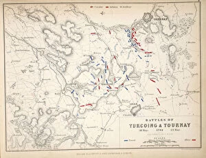
Background imageMaps (celestial & Terrestrial) Collection: Map of the Battles of Turcoing & Tournay, published by William Blackwood and Sons

Map of the Battles of Turcoing & Tournay, published by William Blackwood and Sons
746874 Map of the Battles of Turcoing & Tournay, published by William Blackwood and Sons, Edinburgh & London, 1848 (hand-coloured engraving) by Johnston

Background imageMaps (celestial & Terrestrial) Collection: Map of Paris at the Outbreak of the French Revolution, 1789

Map of Paris at the Outbreak of the French Revolution, 1789
746869 Map of Paris at the Outbreak of the French Revolution, 1789, published by William Blackwood and Sons, Edinburgh & London, 1848 (hand-coloured engraving) by Johnston

Background imageMaps (celestial & Terrestrial) Collection: The Island of Saint Helena, illustration from Linschotens Itinerario

The Island of Saint Helena, illustration from Linschotens Itinerario
741395 The Island of Saint Helena, illustration from Linschotens Itinerario, 1596 (engraving) by van Linschoten, J.H. (1563-1611); Bibliotheque Nationale, Paris

Background imageMaps (celestial & Terrestrial) Collection: German Map showing the extent of surface area and population of the principal countries

German Map showing the extent of surface area and population of the principal countries
741282 German Map showing the extent of surface area and population of the principal countries of Europe, c.1785 (coloured engraving) (see also 741281) by French School

Background imageMaps (celestial & Terrestrial) Collection: Map of Suresnes and its annexe, Puteaux, 1669 (pen & ink on paper)

Map of Suresnes and its annexe, Puteaux, 1669 (pen & ink on paper)
781320 Map of Suresnes and its annexe, Puteaux, 1669 (pen & ink on paper) by French School, (17th century); Musee de Puteaux, France; (add.info.: Plan de Suresnes et de son annexe, Puteaux)

Background imageMaps (celestial & Terrestrial) Collection: Map of Aleppo, c. 1600 (colour litho)

Map of Aleppo, c. 1600 (colour litho)
779776 Map of Aleppo, c.1600 (colour litho) by Ottoman School; Private Collection; (add.info.: Carte d Alep vers 1600. Karte von Aleppo Aober 1600. Illustration of the citadel and city walls)

Background imageMaps (celestial & Terrestrial) Collection: Patriotism (w / c on paper)

Patriotism (w / c on paper)
810313 Patriotism (w/c on paper) by Dadd, Richard (1817-86); Victoria & Albert Museum, London, UK; The Stapleton Collection; English, out of copyright

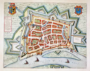
Background imageMaps (celestial & Terrestrial) Collection: Venlo, 1649 (hand-coloured engraving)

Venlo, 1649 (hand-coloured engraving)
478386 Venlo, 1649 (hand-coloured engraving) by Blaeu, Joan (1596-1673); Private Collection; (add.info.: Venlo, a town in the Netherlands on the River Ms near the German border)

Background imageMaps (celestial & Terrestrial) Collection: Map of Essex, 1602 / 03 (engraving)

Map of Essex, 1602 / 03 (engraving)
478401 Map of Essex, 1602/03 (engraving) by Smith, William (c.1550-1618); Private Collection; The Stapleton Collection; English, out of copyright

Background imageMaps (celestial & Terrestrial) Collection: Lier, 1649 (hand-coloured engraving)

Lier, 1649 (hand-coloured engraving)
478394 Lier, 1649 (hand-coloured engraving) by Blaeu, Joan (1596-1673); Private Collection; (add.info.: Lier, now in Belgium)

Background imageMaps (celestial & Terrestrial) Collection: Bergen, Netherlands, 1649 (hand-coloured engraving)

Bergen, Netherlands, 1649 (hand-coloured engraving)
478388 Bergen, Netherlands, 1649 (hand-coloured engraving) by Blaeu, Joan (1596-1673); Private Collection; (add.info.: From Tooneel der Steden vans Konings Nederlanden, met hare beschrijvingen)

Background imageMaps (celestial & Terrestrial) Collection: Educational globe for the blind (bronze) (b / w photo)

Educational globe for the blind (bronze) (b / w photo)
CHT163938 Educational globe for the blind (bronze) (b/w photo) by French School, (19th century); Musee Valentin Hauy, Paris

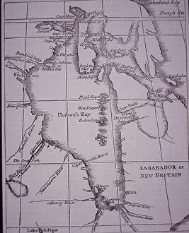
Background imageMaps (celestial & Terrestrial) Collection: Hudson Bay Company, map of Hudson Bay published in 1744, 1744 (engraving)

Hudson Bay Company, map of Hudson Bay published in 1744, 1744 (engraving)
3470672 Hudson Bay Company, map of Hudson Bay published in 1744, 1744 (engraving) by English School, (18th century); Private Collection; Peter Newark Pictures; English, out of copyright

Background imageMaps (celestial & Terrestrial) Collection: Launch of the SS Faraday cable laying ship at W G Armstrong and Mitchell Co

Launch of the SS Faraday cable laying ship at W G Armstrong and Mitchell Co
3786725 Launch of the SS Faraday cable laying ship at W G Armstrong and Mitchell Co, Walker Shipyard, 1874 (b/w photo) by English Photographer

Background imageMaps (celestial & Terrestrial) Collection: Map of the Coast of Guiana, 1646-47

Map of the Coast of Guiana, 1646-47
3786720 Map of the Coast of Guiana, 1646-47; (add.info.: Map of the Coast of Guiana - published in Dudleys Dell Arcano del Mare, 1646- 47)

Background imageMaps (celestial & Terrestrial) Collection: Members of high society at the Waldorf Hotel, 1896

Members of high society at the Waldorf Hotel, 1896
3787898 Members of high society at the Waldorf Hotel, 1896 by Smedley, William Thomas (1858-1920); (add.info.: Members of high society at the Waldorf Hotel, 1896)

Background imageMaps (celestial & Terrestrial) Collection: Italy and Sicily from a Renaissance map of Europe, Jacopo Russo (after), 1528

Italy and Sicily from a Renaissance map of Europe, Jacopo Russo (after), 1528
2910982 Italy and Sicily from a Renaissance map of Europe, Jacopo Russo (after), 1528 by Russo, Jacopo (15th century); (add.info.: Renaissance map of Europe, Jacopo Russo, 1528)

Background imageMaps (celestial & Terrestrial) Collection: Renaissance map of Europe, Jacopo Russo (after) 1528

Renaissance map of Europe, Jacopo Russo (after) 1528
2910977 Renaissance map of Europe, Jacopo Russo (after) 1528 by Russo, Jacopo (15th century); (add.info.: Renaissance map of Europe, Jacopo Russo, 1528)

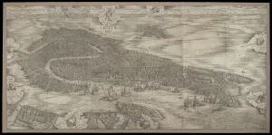
Background imageMaps (celestial & Terrestrial) Collection: View of Venice, 1500 (woodcut)

View of Venice, 1500 (woodcut)
3557439 View of Venice, 1500 (woodcut) by Barbari, Jacopo de (1440/50-a.1515); 132.72x277.5 cm; Minneapolis Institute of Arts, MN

Background imageMaps (celestial & Terrestrial) Collection: Two maps of Taranaki, New Zealand showing Middlesex Regiment operations during the Maori

Two maps of Taranaki, New Zealand showing Middlesex Regiment operations during the Maori
2973892 Two maps of Taranaki, New Zealand showing Middlesex Regiment operations during the Maori War, 1860-72 (colour litho) by English School, (19th century); National Army Museum

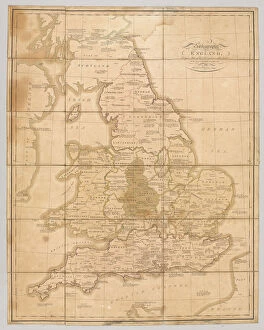
Background imageMaps (celestial & Terrestrial) Collection: Praehagraphy of England, being a map of that Kingdom illustrative of the principle

Praehagraphy of England, being a map of that Kingdom illustrative of the principle
2973891 Praehagraphy of England, being a map of that Kingdom illustrative of the principle battles fought in it, pub. 1807 (coloured engraving) by English School


All Professionally Made to Order for Quick Shipping


-

Why Choose Us?

We are a leading provider of Art Prints and Photo Gifts since 2003, working in partnership with a range of Sporting Clubs, Charities, Museums and Picture Libraries. A large share of profits from any of their images will go directly towards supporting that charity or club. Our archive of images is carefully curated to bring you a wide range of subjects, including landscapes, wildlife, architecture, and more. We ship from our partner labs in the UK, USA, EU (Netherlands) and Australia.
+

How do I place an order?

Ordering is quick & easy - Just follow 5 Simple Steps:
  1. Find your image: Use our search box or browse our online photo Collections to find the image you want.

  2. Choose your print format: Select your desired product and add it to your cart.

  3. Enter your details: If you're a returning customer, simply enter your email address and password, and we'll fill in your billing and shipping address details. All personal details are held securely and are fully GDPR compliant. As standard, we remove all Personally Identifiable Information after 12 months.

  4. Pay for your purchase: We use state-of-the-art security for online shopping and do not have access to your card details.

  5. Sit back and relax: We'll email you confirmation of your order and when it's dispatched. Registered customers can also track orders in the 'My Account' area.

+

How do I pay for an order?

You can pay for your order with most of the major credit and debit cards, or PayPal. For added security, major financial institutions process payment details separately and securely on our behalf. We do not have access to your online payment card details. Online payments are preferred however we do take phone orders. For UK customers only we accept cheques issued against a UK bank.
+

Is my data safe?

We take data security very seriously. We do not have access to your full card details and all payments are requested over a fully secure connection. Additionally, we fully comply with current European and GDPR legislation, and automatically remove all personal data after at most 12 months (unless you have an account with us and have signed in recently). We also have a strict opt-in policy and would never sell your personal details. Your data is only used to fulfill your order promptly and efficiently.
+

Is wall art ready to hang?

For quick and easy installation all wall art, including framed prints, canvas prints and metal prints are supplied with a ready to hang solution on the back. Generally, saw tooth hangers are applied as they allow wall art to hang flush against the wall. The serrated edge of the hanger prevents the frame from shifting or tilting when hung.
+

Are the photo prints fade resistant?

Yes, we use archival quality photo paper photographic paper for vivid reproduction Prints are an accurate representations of the original artwork, which is preserved for artistic character and authenticity. We guarantee they match previews shown on our web site