Fraud Blocker Skip to main content

Home > Fine Art Finder > Maps (celestial & Terrestrial)

Maps (celestial & Terrestrial) Collection (page 2)

1,542 items

Background imageMaps (celestial & Terrestrial) Collection: Insulae lavae, a large folding map of Java with two insets both depicting views of Batavia

Insulae lavae, a large folding map of Java with two insets both depicting views of Batavia (Jakarta) Dutch
BON93407 Insulae lavae, a large folding map of Java with two insets both depicting views of Batavia (Jakarta) Dutch, published by Gerard van Keulen, Amsterdam, c.1715 (coloured engraving) by Reland

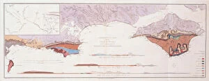
Background imageMaps (celestial & Terrestrial) Collection: Geological Map and Sections of the Isle of Wight and the Adjacent Parts of Hampshire and Dorsetshire

Geological Map and Sections of the Isle of Wight and the Adjacent Parts of Hampshire and Dorsetshire
1765217 Geological Map and Sections of the Isle of Wight and the Adjacent Parts of Hampshire and Dorsetshire, 1816 (hand-coloured engraving) by Webster

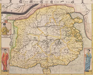
Background imageMaps (celestial & Terrestrial) Collection: Map of China with inset portraits of Matteo Ricci and two Chinese costumed figures, c

Map of China with inset portraits of Matteo Ricci and two Chinese costumed figures, c. 1625-26 (coloured engraving)
BON111186 Map of China with inset portraits of Matteo Ricci and two Chinese costumed figures, c.1625-26 (coloured engraving) by Purchas

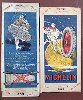
Background imageMaps (celestial & Terrestrial) Collection: Two Michelin maps for the Pontoise and Laon regions of France, c. 1910 (colour litho)

Two Michelin maps for the Pontoise and Laon regions of France, c. 1910 (colour litho)
CHT177221 Two Michelin maps for the Pontoise and Laon regions of France, c.1910 (colour litho) by Rossillon, Marius (O Galop) (1867-1946); Private Collection; (add.info)

Background imageMaps (celestial & Terrestrial) Collection: Michelin map indicating the state of the roads in Southern France, Spring 1929 (colour litho)

Michelin map indicating the state of the roads in Southern France, Spring 1929 (colour litho)
CHT177220 Michelin map indicating the state of the roads in Southern France, Spring 1929 (colour litho) by Rossillon, Marius (O Galop) (1867-1946); Private Collection; (add.info)

Background imageMaps (celestial & Terrestrial) Collection: A Map of the British Empire in America with the French settlements adjacent thereto

A Map of the British Empire in America with the French settlements adjacent thereto, engraved by William Henry Toms (c)
619432 A Map of the British Empire in America with the French settlements adjacent thereto, engraved by William Henry Toms (c.1700-58), c.1733 (hand-coloured engraving) by Popple

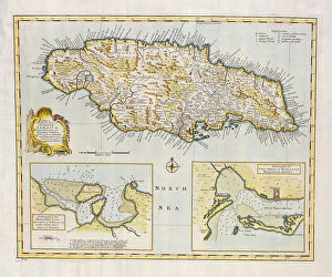
Background imageMaps (celestial & Terrestrial) Collection: Map of the Island of Jamaica, divided into its Principal Parishes c. 1760 (hand-coloured engraving)

Map of the Island of Jamaica, divided into its Principal Parishes c. 1760 (hand-coloured engraving)
BAL42817 Map of the Island of Jamaica, divided into its Principal Parishes c.1760 (hand-coloured engraving) by Bowen, Emanuel (c.1694-1767); O Shea Gallery, London, UK

Background imageMaps (celestial & Terrestrial) Collection: Map of Devonshire, published by Bowles, Tinney and Sayer, London, c

Map of Devonshire, published by Bowles, Tinney and Sayer, London, c. 1777 (hand coloured copper plate engraving)
BAL16026 Map of Devonshire, published by Bowles, Tinney and Sayer, London, c.1777 (hand coloured copper plate engraving) by Bowen, Emanuel (c.1694-1767); Map House, London, UK

Background imageMaps (celestial & Terrestrial) Collection: Ms Lat 696 W. 8. 20 fol. 1r Sundial calendar, from Liber Physiognomiae, c. 1440 (vellum)

Ms Lat 696 W. 8. 20 fol. 1r Sundial calendar, from Liber Physiognomiae, c. 1440 (vellum)
ALG249429 Ms Lat 696 W.8.20 fol.1r Sundial calendar, from Liber Physiognomiae, c.1440 (vellum) by Italian School, (15th century); Biblioteca Estense, Modena, Emilia-Romagna, Italy; Italian

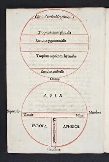
Background imageMaps (celestial & Terrestrial) Collection: Map and diagram of the world, folio a4v of Orbis Breviarium by Zaccaria Lilio (d. c)

Map and diagram of the world, folio a4v of Orbis Breviarium by Zaccaria Lilio (d. c)
488665 Map and diagram of the world, folio a4v of Orbis Breviarium by Zaccaria Lilio (d.c.1522), Florence, 1493 (print & woodcut) by Italian School

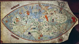
Background imageMaps (celestial & Terrestrial) Collection: Genoese world map, designed by Toscanelli (vellum)

Genoese world map, designed by Toscanelli (vellum)
XPH330307 Genoese world map, designed by Toscanelli (vellum) by Italian School, (15th century); Biblioteca Nazionale Centrale, Florence

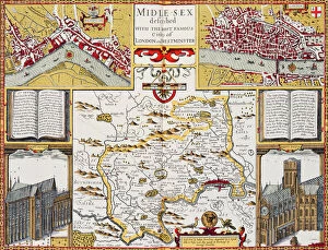
Background imageMaps (celestial & Terrestrial) Collection: Midlesex described with the most famous cities of London and Westminster

Midlesex described with the most famous cities of London and Westminster, from Speeds Theatre of the Empire of Great
XCF186893 Midlesex described with the most famous cities of London and Westminster, from Speeds Theatre of the Empire of Great Britain, 1611-12 (hand coloured copper engraving) by Speed

Background imageMaps (celestial & Terrestrial) Collection: Map of Tarn-et-Garonne with a view of Montauban and portraits of Ingres

Map of Tarn-et-Garonne with a view of Montauban and portraits of Ingres and Jean Parisot de La Valette (colour litho)
PCT3482842 Map of Tarn-et-Garonne with a view of Montauban and portraits of Ingres and Jean Parisot de La Valette (colour litho) by French School

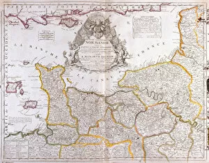
Background imageMaps (celestial & Terrestrial) Collection: Map of Normandy, 1694, from 'Le Theatre du Monde', by Jean-Baptiste Nolin

Map of Normandy, 1694, from "Le Theatre du Monde", by Jean-Baptiste Nolin
LRI3518464 Map of Normandy, 1694, from " Le Theatre du Monde", by Jean-Baptiste Nolin, published 1717 (hand-coloured engraving) by French School

Background imageMaps (celestial & Terrestrial) Collection: View of Rio de Janeiro, Brazil, 1600 (coloured engraving)

View of Rio de Janeiro, Brazil, 1600 (coloured engraving)
GIA3051063 View of Rio de Janeiro, Brazil, 1600 (coloured engraving) by Blaeu, Willem (1571-1638); Biblioteca Angelica, Rome, Italy; eGiancarlo Costa; Dutch, out of copyright

Background imageMaps (celestial & Terrestrial) Collection: Portolan chart of the Mediterranean Coast, depicting the different stages of the Voyage

Portolan chart of the Mediterranean Coast, depicting the different stages of the Voyage
JEB940232 Portolan chart of the Mediterranean Coast, depicting the different stages of the Voyage of Ulysses, as told in Homers Odyssey, 1593 (parchment) by French School

Background imageMaps (celestial & Terrestrial) Collection: The Pillars of Hercules (colour litho)

The Pillars of Hercules (colour litho)
GIA940229 The Pillars of Hercules (colour litho) by French School, (19th century); Private Collection; (add.info.: The Pillars of Hercules was the phrase that was applied in Antiquity to)

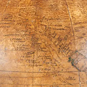
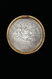
Background imageMaps (celestial & Terrestrial) Collection: Early English terrestrial globe, c. 1673 (engraving, brass, walnut & oak)

Early English terrestrial globe, c. 1673 (engraving, brass, walnut & oak)
3482914 Early English terrestrial globe, c.1673 (engraving, brass, walnut & oak) by Berry, William (1639-1718) & Morden, Robert (c.1650-1703); height: 53 cm; Private Collection; (add.info)

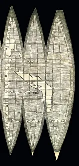
Background imageMaps (celestial & Terrestrial) Collection: World map in the form of a set of terrestrial globe gores, 1507 (woodcut)

World map in the form of a set of terrestrial globe gores, 1507 (woodcut)
3482910 World map in the form of a set of terrestrial globe gores, 1507 (woodcut) by Waldseemuller, Martin (c.1470-c.1522); 18x34.4 cm; Private Collection; (add.info)

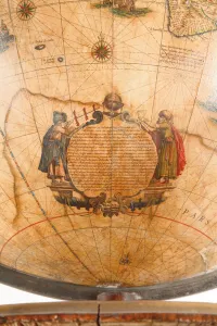
Background imageMaps (celestial & Terrestrial) Collection: Large pair of library globes, the terrestrial 1645 / 48, the celestial after c

Large pair of library globes, the terrestrial 1645 / 48, the celestial after c
3482878 Large pair of library globes, the terrestrial 1645/48, the celestial after c.1630 (plaster, wood & engraved paper) by Blaeu

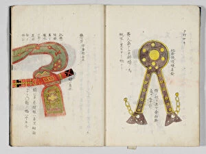
Background imageMaps (celestial & Terrestrial) Collection: Sangoku tsuran zusetsu (Illustrated General Survey of the Three Countries)

Sangoku tsuran zusetsu (Illustrated General Survey of the Three Countries)
3502613 Sangoku tsuran zusetsu (Illustrated General Survey of the Three Countries), 1785 (colour woodblock print) by Shihei, Hayashi (1738-93); Private Collection; (add.info.: SHIHEI)

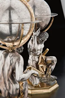
Background imageMaps (celestial & Terrestrial) Collection: Two exceptional terrestrial and celestial globes, supported by Hercules and Atlas

Two exceptional terrestrial and celestial globes, supported by Hercules and Atlas
3482928 Two exceptional terrestrial and celestial globes, supported by Hercules and Atlas, Augsburg, 1697-99 (silver & silver-gilt) by Drentwett

Background imageMaps (celestial & Terrestrial) Collection: Two exceptional terrestrial and celestial globes, supported by Hercules and Atlas

Two exceptional terrestrial and celestial globes, supported by Hercules and Atlas
3482917 Two exceptional terrestrial and celestial globes, supported by Hercules and Atlas, Augsburg, 1697-99 (silver & silver-gilt) by Drentwett

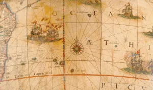
Background imageMaps (celestial & Terrestrial) Collection: Detail of fighting ships in the Atlantic Ocean from a terrestrial globe 1645 / 48 (plaster

Detail of fighting ships in the Atlantic Ocean from a terrestrial globe 1645 / 48 (plaster
3482881 Detail of fighting ships in the Atlantic Ocean from a terrestrial globe 1645/48 (plaster, wood & engraved paper) by Blaeu

Background imageMaps (celestial & Terrestrial) Collection: Map from Red Books, for Mogenhanger in Bedfordshire

Map from Red Books, for Mogenhanger in Bedfordshire
495319 Map from Red Books, for Mogenhanger in Bedfordshire, a Seat of Godfrey Thornton Esq. 1792 (w/c on paper) (see also 495318 and 497306-7) by Repton

Background imageMaps (celestial & Terrestrial) Collection: Map, illustration from The Liber Insularum Archipelagi (vellum)

Map, illustration from The Liber Insularum Archipelagi (vellum)
480612 Map, illustration from The Liber Insularum Archipelagi (vellum) by Buondelmonti, Cristoforo (1385-1430); 25.4x16.4 cm; Private Collection; (add.info)

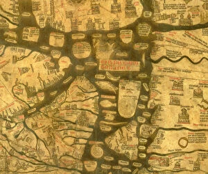
Background imageMaps (celestial & Terrestrial) Collection: Detail of the Mediterranean from the Mappa Mundi, c. 1290 (vellum)

Detail of the Mediterranean from the Mappa Mundi, c. 1290 (vellum)
3619784 Detail of the Mediterranean from the Mappa Mundi, c.1290 (vellum) by Richard of Haldingham (Richard de Bello) (fl.c.1260-1305); Hereford Cathedral, Herefordshire

Background imageMaps (celestial & Terrestrial) Collection: Map of Philadelphia, from an Atlas of the United States, 1824 (engraving)

Map of Philadelphia, from an Atlas of the United States, 1824 (engraving)
497565 Map of Philadelphia, from an Atlas of the United States, 1824 (engraving) by KlinckowstrAom, Axel Leonhard (1775-1837); 56x44 cm; Gilder Lehrman Collection, New York

Background imageMaps (celestial & Terrestrial) Collection: Map of the United States, 1816 (engraving)

Map of the United States, 1816 (engraving)
497555 Map of the United States, 1816 (engraving) by Melish, John (1771-1822); Gilder Lehrman Collection, New York, USA; eGilder Lehrman Institute of American History; American, out of copyright

Background imageMaps (celestial & Terrestrial) Collection: A sketch of the operations before Charlestown, the capital of South Carolina, c

A sketch of the operations before Charlestown, the capital of South Carolina, c
696019 A sketch of the operations before Charlestown, the capital of South Carolina, c.1780 (colour litho) by DesBarres, Joseph Frederick Wallet (1721-1824); 110x81 cm; Gilder Lehrman Collection

Background imageMaps (celestial & Terrestrial) Collection: Map of the Tribe of Asher, 1590 (engraving)

Map of the Tribe of Asher, 1590 (engraving)
695045 Map of the Tribe of Asher, 1590 (engraving) by Adrichom, Christian van (1533-85) (after); Private Collection; (add.info)

Background imageMaps (celestial & Terrestrial) Collection: Map of the travels of Abraham, Isaac and Jacob, 1652 (engraving)

Map of the travels of Abraham, Isaac and Jacob, 1652 (engraving)
695034 Map of the travels of Abraham, Isaac and Jacob, 1652 (engraving) by Janssonius, Jan (1588-1664) (after); Bibliotheque Nationale, Paris

Background imageMaps (celestial & Terrestrial) Collection: Plan of the Bay and City of Rio de Janeiro and the disposition of the French

Plan of the Bay and City of Rio de Janeiro and the disposition of the French
694860 Plan of the Bay and City of Rio de Janeiro and the disposition of the French and Portuguese naval forces during the French attack under Duguay-Trouin in 1711, c.1730 (engraving) by Coquart

Background imageMaps (celestial & Terrestrial) Collection: Map of the Indian Peninsula, 1733 (hand-coloured engraving)

Map of the Indian Peninsula, 1733 (hand-coloured engraving)
619431 Map of the Indian Peninsula, 1733 (hand-coloured engraving) by Homann Heirs Company (1724-1848); Private Collection; (add.info)

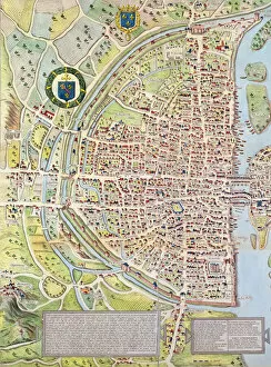
Background imageMaps (celestial & Terrestrial) Collection: Detail of the Right Bank, from the map of Paris c. 1540

Detail of the Right Bank, from the map of Paris c. 1540
617394 Detail of the Right Bank, from the map of Paris c. 1540, known as the Plan de la Tapisserie, made as a tapestry c. 1570, 1818 (colour engraving) by Naudet

Background imageMaps (celestial & Terrestrial) Collection: Map of Spain said to have been used by the Duke of Wellington

Map of Spain said to have been used by the Duke of Wellington
1772183 Map of Spain said to have been used by the Duke of Wellington, 1808-14 (coloured engraving) by English School, (19th century); National Army Museum

Background imageMaps (celestial & Terrestrial) Collection: The Constellations (Plate XXIV) Fluvius Eridanus, Orion; Lepus, Columba Noachi

The Constellations (Plate XXIV) Fluvius Eridanus, Orion; Lepus, Columba Noachi
956772 The Constellations (Plate XXIV) Fluvius Eridanus, Orion; Lepus, Columba Noachi, Cela Sculptoris, Psalterium Georgii, Horologium, Equuleus Pictorius, Brandenbergium Sceptrum

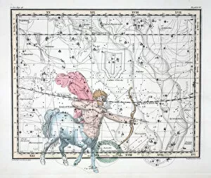
Background imageMaps (celestial & Terrestrial) Collection: The Constellations (Plate XX) Sagittarius, from A Celestial Atlas

The Constellations (Plate XX) Sagittarius, from A Celestial Atlas
956769 The Constellations (Plate XX) Sagittarius, from A Celestial Atlas by Alexander Jamieson, pub. London 1822 (hand coloured engraving) by Jamieson

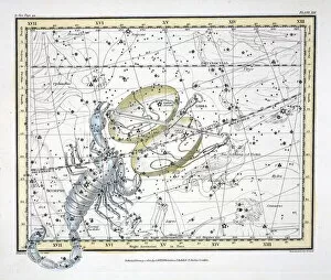
Background imageMaps (celestial & Terrestrial) Collection: The Constellations (Plate XIX) Libra and Scorpio, from A Celestial Atlas

The Constellations (Plate XIX) Libra and Scorpio, from A Celestial Atlas
956768 The Constellations (Plate XIX) Libra and Scorpio, from A Celestial Atlas by Alexander Jamieson, pub. London 1822 (hand coloured engraving) by Jamieson

Background imageMaps (celestial & Terrestrial) Collection: The Constellations (Plate XVI) Cancer, from A Celestial Atlas

The Constellations (Plate XVI) Cancer, from A Celestial Atlas
956766 The Constellations (Plate XVI) Cancer, from A Celestial Atlas by Alexander Jamieson, pub. London 1822 (hand coloured engraving) by Jamieson

Background imageMaps (celestial & Terrestrial) Collection: The Moon, Venus and Saturn (Plate XXX), from A Celestial Atlas

The Moon, Venus and Saturn (Plate XXX), from A Celestial Atlas
956782 The Moon, Venus and Saturn (Plate XXX), from A Celestial Atlas by Alexander Jamieson, pub. London 1822 (hand coloured engraving) by Jamieson

Background imageMaps (celestial & Terrestrial) Collection: The Constellations (Plate XI) Cygnus, Lacerta and Via Lactea

The Constellations (Plate XI) Cygnus, Lacerta and Via Lactea
956776 The Constellations (Plate XI) Cygnus, Lacerta and Via Lactea, from A Celestial Atlas by Alexander Jamieson, pub. London 1822 (hand coloured engraving) by Jamieson

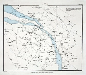
Background imageMaps (celestial & Terrestrial) Collection: Map showing the principal stars which are visible in Great Britain (Plate (XXIX)

Map showing the principal stars which are visible in Great Britain (Plate (XXIX)
956775 Map showing the principal stars which are visible in Great Britain (Plate (XXIX), from A Celestial Atlas by Alexander Jamieson, pub

Background imageMaps (celestial & Terrestrial) Collection: The Constellations (Plate XXVII) Hydra Continua, Crater, Covus, Centaurus et Lupus

The Constellations (Plate XXVII) Hydra Continua, Crater, Covus, Centaurus et Lupus
956774 The Constellations (Plate XXVII) Hydra Continua, Crater, Covus, Centaurus et Lupus, from A Celestial Atlas by Alexander Jamieson, pub

Background imageMaps (celestial & Terrestrial) Collection: The Constellations (Plate XVII) Leo, from A Celestial Atlas

The Constellations (Plate XVII) Leo, from A Celestial Atlas
956767 The Constellations (Plate XVII) Leo, from A Celestial Atlas by Alexander Jamieson, pub. London 1822 (hand coloured engraving) by Jamieson

Background imageMaps (celestial & Terrestrial) Collection: The Constellations (Plate XV) Gemini, from A Celestial Atlas

The Constellations (Plate XV) Gemini, from A Celestial Atlas
956765 The Constellations (Plate XV) Gemini, from A Celestial Atlas by Alexander Jamieson, pub. London 1822 (hand coloured engraving) by Jamieson

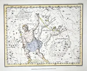
Background imageMaps (celestial & Terrestrial) Collection: The Constellations (Plate VII) Bootes and Mons Maenalus

The Constellations (Plate VII) Bootes and Mons Maenalus
956760 The Constellations (Plate VII) Bootes and Mons Maenalus, Asterion and Chara or Canes Venatici, Coma Berenices, , from A Celestial Atlas by Alexander Jamieson, pub

Background imageMaps (celestial & Terrestrial) Collection: Ancient Hemispheres of the World, plate 94 from The Celestial Atlas

Ancient Hemispheres of the World, plate 94 from The Celestial Atlas
STC90199 Ancient Hemispheres of the World, plate 94 from The Celestial Atlas, or the Harmony of the Universe (Atlas coelestis seu harmonia macrocosmica) pub


All Professionally Made to Order for Quick Shipping


-

Why Choose Us?

We are a leading provider of Art Prints and Photo Gifts since 2003, working in partnership with a range of Sporting Clubs, Charities, Museums and Picture Libraries. A large share of profits from any of their images will go directly towards supporting that charity or club. Our archive of images is carefully curated to bring you a wide range of subjects, including landscapes, wildlife, architecture, and more. We ship from our partner labs in the UK, USA, EU (Netherlands) and Australia.
+

How do I place an order?

Ordering is quick & easy - Just follow 5 Simple Steps:
  1. Find your image: Use our search box or browse our online photo Collections to find the image you want.

  2. Choose your print format: Select your desired product and add it to your cart.

  3. Enter your details: If you're a returning customer, simply enter your email address and password, and we'll fill in your billing and shipping address details. All personal details are held securely and are fully GDPR compliant. As standard, we remove all Personally Identifiable Information after 12 months.

  4. Pay for your purchase: We use state-of-the-art security for online shopping and do not have access to your card details.

  5. Sit back and relax: We'll email you confirmation of your order and when it's dispatched. Registered customers can also track orders in the 'My Account' area.

+

How do I pay for an order?

You can pay for your order with most of the major credit and debit cards, or PayPal. For added security, major financial institutions process payment details separately and securely on our behalf. We do not have access to your online payment card details. Online payments are preferred however we do take phone orders. For UK customers only we accept cheques issued against a UK bank.
+

Is my data safe?

We take data security very seriously. We do not have access to your full card details and all payments are requested over a fully secure connection. Additionally, we fully comply with current European and GDPR legislation, and automatically remove all personal data after at most 12 months (unless you have an account with us and have signed in recently). We also have a strict opt-in policy and would never sell your personal details. Your data is only used to fulfill your order promptly and efficiently.
+

Is wall art ready to hang?

For quick and easy installation all wall art, including framed prints, canvas prints and metal prints are supplied with a ready to hang solution on the back. Generally, saw tooth hangers are applied as they allow wall art to hang flush against the wall. The serrated edge of the hanger prevents the frame from shifting or tilting when hung.
+

Are the photo prints fade resistant?

Yes, we use archival quality photo paper photographic paper for vivid reproduction Prints are an accurate representations of the original artwork, which is preserved for artistic character and authenticity. We guarantee they match previews shown on our web site