Fraud Blocker Skip to main content

Home > Fine Art Finder > Maps (celestial & Terrestrial)

Maps (celestial & Terrestrial) Collection (page 6)

1,542 items

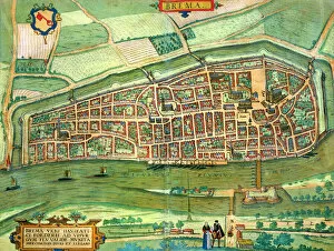
Background imageMaps (celestial & Terrestrial) Collection: Map of Bremen, from Civitates Orbis Terrarum by Georg Braun (1541-1622

Map of Bremen, from Civitates Orbis Terrarum by Georg Braun (1541-1622
STC138937 Map of Bremen, from Civitates Orbis Terrarum by Georg Braun (1541-1622) and Frans Hogenberg (1535-90) c.1572-1617 (coloured engraving) by Hoefnagel

Background imageMaps (celestial & Terrestrial) Collection: Map of Szolnok, from Civitates Orbis Terrarum by Georg Braun (1541-1622

Map of Szolnok, from Civitates Orbis Terrarum by Georg Braun (1541-1622
STC138934 Map of Szolnok, from Civitates Orbis Terrarum by Georg Braun (1541-1622) and Frans Hogenberg (1535-90) 1617 (coloured engraving) by Hoefnagel

Background imageMaps (celestial & Terrestrial) Collection: Maps of York, Shrewsbury, Lancaster, and Richmond, from Civitates Orbis Terrarum

Maps of York, Shrewsbury, Lancaster, and Richmond, from Civitates Orbis Terrarum
STC138925 Maps of York, Shrewsbury, Lancaster, and Richmond, from Civitates Orbis Terrarum by Georg Braun (1541-1622) and Frans Hogenberg (1535-90) c.1572-1617 (coloured engraving) by Hoefnagel

Background imageMaps (celestial & Terrestrial) Collection: Map of Aurelia, from Civitates Orbis Terrarum by Georg Braun (1541-1622

Map of Aurelia, from Civitates Orbis Terrarum by Georg Braun (1541-1622
STC138919 Map of Aurelia, from Civitates Orbis Terrarum by Georg Braun (1541-1622) and Frans Hogenberg (1535-90) c.1572-1617 (coloured engraving) by Hoefnagel

Background imageMaps (celestial & Terrestrial) Collection: Map of Luxembourg, from Civitates Orbis Terrarum

Map of Luxembourg, from Civitates Orbis Terrarum
STC138913 Map of Luxembourg, from Civitates Orbis Terrarum by Georg Braun (1541-1622) and Frans Hogenberg (1535-90) c.1572-1617 (coloured engraving) by Hoefnagel

Background imageMaps (celestial & Terrestrial) Collection: Map of Mstricht, from Civitates Orbis Terrarum

Map of Mstricht, from Civitates Orbis Terrarum
STC138912 Map of Mstricht, from Civitates Orbis Terrarum by Georg Braun (1541-1622) and Frans Hogenberg (1535-90) c.1572-1617 (coloured engraving) by Hoefnagel

Background imageMaps (celestial & Terrestrial) Collection: A Map of Africa to Illustrate the Travels of David Livingstone (1813-73)

A Map of Africa to Illustrate the Travels of David Livingstone (1813-73)
STC177025 A Map of Africa to Illustrate the Travels of David Livingstone (1813-73), Henry Morton Stanley (1841-1904) and Verney Lovett Cameron (1844-94) (colour litho) by English School

Background imageMaps (celestial & Terrestrial) Collection: French school textbook map of Indochina, 1905 (colour litho)

French school textbook map of Indochina, 1905 (colour litho)
CHT216702 French school textbook map of Indochina, 1905 (colour litho) by French School, (20th century); Private Collection; eArchives Charmet; French, out of copyright

Background imageMaps (celestial & Terrestrial) Collection: View from the north of the Aztec city of Tenochtitlan, from

View from the north of the Aztec city of Tenochtitlan, from
TRV230404 View from the north of the Aztec city of Tenochtitlan, from Relatione della Citta del Temistitan by Giovanni Battista Ramusio (1485-1557) published in Venice 1606 (engraving) (b/w photo)

Background imageMaps (celestial & Terrestrial) Collection: The South Pole, detail from the Mappamonde a Projection Cordiforme

The South Pole, detail from the Mappamonde a Projection Cordiforme
CHT223721 The South Pole, detail from the Mappamonde a Projection Cordiforme, 1531 (engraving) (b/w photo) by Fine, Oronce (1494-1555); Private Collection; eArchives Charmet; French, out of copyright

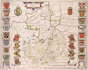
Background imageMaps (celestial & Terrestrial) Collection: Map of Cambridgeshire, published Amsterdam c. 1647-48 (hand-coloured engraving)

Map of Cambridgeshire, published Amsterdam c. 1647-48 (hand-coloured engraving)
STC222030 Map of Cambridgeshire, published Amsterdam c.1647-48 (hand-coloured engraving) by Blaeu, Willem (1571-1638) and Joan (1596-1673); Private Collection; (add.info)

Background imageMaps (celestial & Terrestrial) Collection: Map of Britain and Ireland, published Paris 1640 (engraving)

Map of Britain and Ireland, published Paris 1640 (engraving)
STC222025 Map of Britain and Ireland, published Paris 1640 (engraving) by Sanson D Abbeville, Nicolas (1600-67); Private Collection; (add.info.: Royaume D Angleterre)

Background imageMaps (celestial & Terrestrial) Collection: A Map inspired by Candide by Francois Voltaire (1694-1778

A Map inspired by Candide by Francois Voltaire (1694-1778
CHT171374 A Map inspired by Candide by Francois Voltaire (1694-1778) for a competition organised by the Ecole Nationale des Ponts et Chaussees in Paris

Background imageMaps (celestial & Terrestrial) Collection: Map of the County of Middlesex, published 1819 (print)

Map of the County of Middlesex, published 1819 (print)
STC169245 Map of the County of Middlesex, published 1819 (print) by Greenwood, C. (fl.1818-19); Private Collection; (add.info)

Background imageMaps (celestial & Terrestrial) Collection: Map of Venice, first half of 17th century (panel)

Map of Venice, first half of 17th century (panel)
FTB64062 Map of Venice, first half of 17th century (panel) by Barzenti, G. (17th century); Museo Correr, Venice, Italy; Italian, out of copyright

Background imageMaps (celestial & Terrestrial) Collection: Map of London, from 'Civitates Orbis Terrarum', by Georg Braun (1542-1622)

Map of London, from "Civitates Orbis Terrarum", by Georg Braun (1542-1622) and Frans Hogenburg (1635-90), c
GHL66112 Map of London, from "Civitates Orbis Terrarum", by Georg Braun (1542-1622) and Frans Hogenburg (1635-90), c.1572 (coloured engraving) (see also 51896 & 58543) by Hoefnagel

Background imageMaps (celestial & Terrestrial) Collection: 'Londinium Antiqua', map of London, pub. by William Darton

"Londinium Antiqua", map of London, pub. by William Darton
GHL6266 " Londinium Antiqua", map of London, pub. by William Darton, 1563 (hand-coloured engraving) by English School, (16th century); London Metropolitan Archives

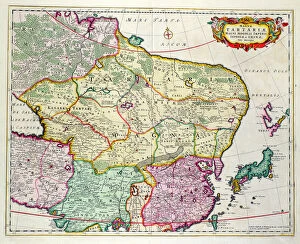
Background imageMaps (celestial & Terrestrial) Collection: Map of Mongolia showing part of Russia, Japan and China, c. 1680 (coloured engraving)

Map of Mongolia showing part of Russia, Japan and China, c. 1680 (coloured engraving)
BAL42852 Map of Mongolia showing part of Russia, Japan and China, c.1680 (coloured engraving) by Wit, Frederick de (1630-1706); O Shea Gallery, London, UK; Dutch, out of copyright

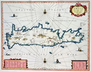
Background imageMaps (celestial & Terrestrial) Collection: Map showing the Island of Crete, c. 1570 (coloured engraving)

Map showing the Island of Crete, c. 1570 (coloured engraving)
BAL42826 Map showing the Island of Crete, c.1570 (coloured engraving) by Ortelius, Abraham (1527-98); O Shea Gallery, London, UK; Flemish, out of copyright

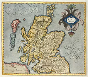
Background imageMaps (celestial & Terrestrial) Collection: Map of the Kingdom of Scotland, 17th century

Map of the Kingdom of Scotland, 17th century
BAL42814 Map of the Kingdom of Scotland, 17th century by Unknown Artist, (17th century); O Shea Gallery, London, UK; (add.info.: Influenced by the Gerard Mercator Atlas of 1565.); out of copyright

Background imageMaps (celestial & Terrestrial) Collection: Map of the County of Cornwall, 1579 (hand-coloured engraving)

Map of the County of Cornwall, 1579 (hand-coloured engraving)
OPT18636 Map of the County of Cornwall, 1579 (hand-coloured engraving) by Saxton, Christopher (c.1542-c.1610); Private Collection; English, out of copyright

Background imageMaps (celestial & Terrestrial) Collection: The Great Fire, 1666 (coloured engraving)

The Great Fire, 1666 (coloured engraving)
GHL27717 The Great Fire, 1666 (coloured engraving) by Doornik, Marcus Willemsz (17th century); London Metropolitan Archives, City of London; eLondon Metropolitan Archives; Dutch, out of copyright

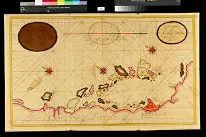
Background imageMaps (celestial & Terrestrial) Collection: Map of the Bay of Darien, 1709-13 (colour litho)

Map of the Bay of Darien, 1709-13 (colour litho)
VEN1126513 Map of the Bay of Darien, 1709-13 (colour litho) by Keulen, Gerard van (1678-1726); Biblioteca Angelica, Rome, Italy; (add.info)

Background imageMaps (celestial & Terrestrial) Collection: Map of the Bay of Rio de Janeiro, 1709-13 (colour litho)

Map of the Bay of Rio de Janeiro, 1709-13 (colour litho)
VEN3051065 Map of the Bay of Rio de Janeiro, 1709-13 (colour litho) by Keulen, Gerard van (1678-1726); Biblioteca Angelica, Rome, Italy; Photo eMarco Ravenna; Dutch, out of copyright

Background imageMaps (celestial & Terrestrial) Collection: Terrestrial Globe, 1632 (engraving)

Terrestrial Globe, 1632 (engraving)
2654783 Terrestrial Globe, 1632 (engraving) by Greuter, Matthaus (c.1556-1638); each segment 33.5x12.5 cm; Private Collection; Photo eChristies Images; French, out of copyright

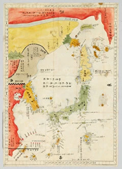
Background imageMaps (celestial & Terrestrial) Collection: Sangoku tsuran zusetsu (Illustrated General Survey of the Three Countries)

Sangoku tsuran zusetsu (Illustrated General Survey of the Three Countries)
3502614 Sangoku tsuran zusetsu (Illustrated General Survey of the Three Countries), 1785 (colour woodblock print) by Shihei, Hayashi (1738-93); Private Collection; (add.info.: SHIHEI)

Background imageMaps (celestial & Terrestrial) Collection: Mappa Mundi, the first printed map of the world, from Etymologiae

Mappa Mundi, the first printed map of the world, from Etymologiae
3482941 Mappa Mundi, the first printed map of the world, from Etymologiae by Isidorus Hispalensis, Augsburg: GAonther Zainer, 19 November 1472 (woodcut) by German School

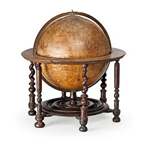
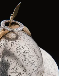
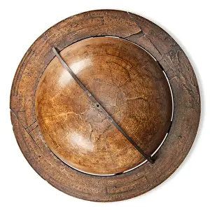
Background imageMaps (celestial & Terrestrial) Collection: Early English terrestrial globe, c. 1673 (engraving, brass, walnut & oak)

Early English terrestrial globe, c. 1673 (engraving, brass, walnut & oak)
3482913 Early English terrestrial globe, c.1673 (engraving, brass, walnut & oak) by Berry, William (1639-1718) & Morden, Robert (c.1650-1703); height: 53 cm; Private Collection; (add.info)

Background imageMaps (celestial & Terrestrial) Collection: Two exceptional terrestrial and celestial globes, supported by Hercules and Atlas

Two exceptional terrestrial and celestial globes, supported by Hercules and Atlas
3482912 Two exceptional terrestrial and celestial globes, supported by Hercules and Atlas, Augsburg, 1697-99 (silver & silver-gilt) by Drentwett

Background imageMaps (celestial & Terrestrial) Collection: Early English terrestrial globe, c. 1673 (engraving, brass, walnut & oak)

Early English terrestrial globe, c. 1673 (engraving, brass, walnut & oak)
3482911 Early English terrestrial globe, c.1673 (engraving, brass, walnut & oak) by Berry, William (1639-1718) & Morden, Robert (c.1650-1703); height: 53 cm; Private Collection; (add.info)

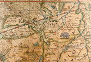
Background imageMaps (celestial & Terrestrial) Collection: Detail of Africa from a terrestrial globe 1645 / 48 (plaster, wood & engraved paper)

Detail of Africa from a terrestrial globe 1645 / 48 (plaster, wood & engraved paper)
3482883 Detail of Africa from a terrestrial globe 1645/48 (plaster, wood & engraved paper) by Blaeu, Willem (1571-1638); height: 99 cm; Private Collection; (add.info)

Background imageMaps (celestial & Terrestrial) Collection: Map of the Congo region, from an album belonging to Henry Morton Stanley (b / w photo)

Map of the Congo region, from an album belonging to Henry Morton Stanley (b / w photo)
CH405684 Map of the Congo region, from an album belonging to Henry Morton Stanley (b/w photo) by English School, (19th century); Private Collection; (add.info)

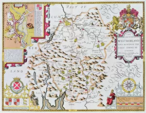
Background imageMaps (celestial & Terrestrial) Collection: The Countie of Westmorland, engraved by Jodocus Hondius (1563-1612) from John Speed

The Countie of Westmorland, engraved by Jodocus Hondius (1563-1612) from John Speed
XCF113471 The Countie of Westmorland, engraved by Jodocus Hondius (1563-1612) from John Speeds Theatre of the Empire of Great Britain, pub

Background imageMaps (celestial & Terrestrial) Collection: Map of London and adjacent country ten miles round

Map of London and adjacent country ten miles round
GHL32740 Map of London and adjacent country ten miles round by English School, (18th century); London Metropolitan Archives

Background imageMaps (celestial & Terrestrial) Collection: Map of Mongolia showing Japan and China, c. 1680 (coloured engraving)

Map of Mongolia showing Japan and China, c. 1680 (coloured engraving)
BAL42851 Map of Mongolia showing Japan and China, c.1680 (coloured engraving) by Wit, Frederick de (1630-1706); O Shea Gallery, London, UK; Dutch, out of copyright

Background imageMaps (celestial & Terrestrial) Collection: Map of the Kingdom of Scotland, 17th century

Map of the Kingdom of Scotland, 17th century
BAL42813 Map of the Kingdom of Scotland, 17th century by Unknown Artist, (17th century); O Shea Gallery, London, UK; out of copyright

Background imageMaps (celestial & Terrestrial) Collection: Map of London, from Civitates Orbis Terrarum, by Georg Braun (1542-1622

Map of London, from Civitates Orbis Terrarum, by Georg Braun (1542-1622
GHL51896 Map of London, from Civitates Orbis Terrarum, by Georg Braun (1542-1622) and Frans Hogenburg (1635-90), c.1572 (coloured engraving) by Hoefnagel

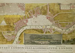
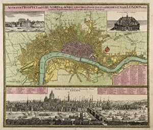
Background imageMaps (celestial & Terrestrial) Collection: Map and Prospect of London, c. 1710 (hand coloured engraving)

Map and Prospect of London, c. 1710 (hand coloured engraving)
GHL45972 Map and Prospect of London, c.1710 (hand coloured engraving) by Homann, Johann Baptista (1663-1724); London Metropolitan Archives, City of London; eLondon Metropolitan Archives; German

Background imageMaps (celestial & Terrestrial) Collection: Map of the Americas, published by Homann, 1746 (colour engraving)

Map of the Americas, published by Homann, 1746 (colour engraving)
STC214678 Map of the Americas, published by Homann, 1746 (colour engraving) by Boehm, A. Gottlieb (fl.1746); Private Collection; The Stapleton Collection; German, out of copyright

Background imageMaps (celestial & Terrestrial) Collection: Map of the Russian empire in the sixteenth century, copy of an original of 1571

Map of the Russian empire in the sixteenth century, copy of an original of 1571
CHT205700 Map of the Russian empire in the sixteenth century, copy of an original of 1571 (colour litho) by Ortelius, Abraham (1527-98) (after); Bibliotheque des Arts Decoratifs, Paris

Background imageMaps (celestial & Terrestrial) Collection: Map of Rhode Island at the time of its occupation 1780-81 by the French Army

Map of Rhode Island at the time of its occupation 1780-81 by the French Army
CHT231121 Map of Rhode Island at the time of its occupation 1780-81 by the French Army on the orders of Jean-Baptiste de Vimeur (1725-1807) Count of Rochambeau (colour litho) by French School

Background imageMaps (celestial & Terrestrial) Collection: Map of Bergen, from Civitates Orbis Terrarum by Georg Brau (1541-1622

Map of Bergen, from Civitates Orbis Terrarum by Georg Brau (1541-1622
STC138990 Map of Bergen, from Civitates Orbis Terrarum by Georg Brau (1541-1622) and Franz Hogenberg (1535-90) c.1571-1600 (coloured engraving) by Scholeus

Background imageMaps (celestial & Terrestrial) Collection: Map of WRATISLAVA Bresslaw, from Civitates Orbis Terrarum

Map of WRATISLAVA Bresslaw, from Civitates Orbis Terrarum
STC138988 Map of WRATISLAVA Bresslaw, from Civitates Orbis Terrarum by Georg Braun (1541-1622) and Frans Hogenberg (1535-90) c.1572-1617 (coloured engraving) by Hoefnagel

Background imageMaps (celestial & Terrestrial) Collection: Map of Namur, from Civitates Orbis Terrarum by Georg Braun (1541-1622

Map of Namur, from Civitates Orbis Terrarum by Georg Braun (1541-1622
STC138981 Map of Namur, from Civitates Orbis Terrarum by Georg Braun (1541-1622) and Frans Hogenberg (1535-90) c.1572-1617 (coloured engraving) by Hoefnagel

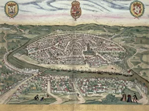
Background imageMaps (celestial & Terrestrial) Collection: Map of Seville, from Civitates Orbis Terrarum by Georg Braun (1541-1622

Map of Seville, from Civitates Orbis Terrarum by Georg Braun (1541-1622
STC138975 Map of Seville, from Civitates Orbis Terrarum by Georg Braun (1541-1622) and Frans Hogenberg (1535-90) c.1572-1617 (coloured engraving) by Hoefnagel

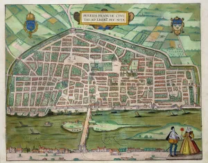
Background imageMaps (celestial & Terrestrial) Collection: Map of Arras, from Civitates Orbis Terrarum by Georg Braun (1541-1622

Map of Arras, from Civitates Orbis Terrarum by Georg Braun (1541-1622
STC138968 Map of Arras, from Civitates Orbis Terrarum by Georg Braun (1541-1622) and Frans Hogenberg (1535-90) c.1572-1617 (coloured engraving) by Hoefnagel

Background imageMaps (celestial & Terrestrial) Collection: Map of Zamosc, from Civitates Orbis Terrarum by Georg Braun (1541-1622

Map of Zamosc, from Civitates Orbis Terrarum by Georg Braun (1541-1622
STC138958 Map of Zamosc, from Civitates Orbis Terrarum by Georg Braun (1541-1622) and Frans Hogenberg (1535-90) c.1572-1617 (coloured engraving) by Hoefnagel

Background imageMaps (celestial & Terrestrial) Collection: Map of Padua, from Civitates Orbis Terrarum by Georg Braun (1541-1622

Map of Padua, from Civitates Orbis Terrarum by Georg Braun (1541-1622
STC138956 Map of Padua, from Civitates Orbis Terrarum by Georg Braun (1541-1622) and Frans Hogenberg (1535-90) c.1572-1617 (coloured engraving) by Hoefnagel


All Professionally Made to Order for Quick Shipping


-

Why Choose Us?

We are a leading provider of Art Prints and Photo Gifts since 2003, working in partnership with a range of Sporting Clubs, Charities, Museums and Picture Libraries. A large share of profits from any of their images will go directly towards supporting that charity or club. Our archive of images is carefully curated to bring you a wide range of subjects, including landscapes, wildlife, architecture, and more. We ship from our partner labs in the UK, USA, EU (Netherlands) and Australia.
+

How do I place an order?

Ordering is quick & easy - Just follow 5 Simple Steps:
  1. Find your image: Use our search box or browse our online photo Collections to find the image you want.

  2. Choose your print format: Select your desired product and add it to your cart.

  3. Enter your details: If you're a returning customer, simply enter your email address and password, and we'll fill in your billing and shipping address details. All personal details are held securely and are fully GDPR compliant. As standard, we remove all Personally Identifiable Information after 12 months.

  4. Pay for your purchase: We use state-of-the-art security for online shopping and do not have access to your card details.

  5. Sit back and relax: We'll email you confirmation of your order and when it's dispatched. Registered customers can also track orders in the 'My Account' area.

+

How do I pay for an order?

You can pay for your order with most of the major credit and debit cards, or PayPal. For added security, major financial institutions process payment details separately and securely on our behalf. We do not have access to your online payment card details. Online payments are preferred however we do take phone orders. For UK customers only we accept cheques issued against a UK bank.
+

Is my data safe?

We take data security very seriously. We do not have access to your full card details and all payments are requested over a fully secure connection. Additionally, we fully comply with current European and GDPR legislation, and automatically remove all personal data after at most 12 months (unless you have an account with us and have signed in recently). We also have a strict opt-in policy and would never sell your personal details. Your data is only used to fulfill your order promptly and efficiently.
+

Is wall art ready to hang?

For quick and easy installation all wall art, including framed prints, canvas prints and metal prints are supplied with a ready to hang solution on the back. Generally, saw tooth hangers are applied as they allow wall art to hang flush against the wall. The serrated edge of the hanger prevents the frame from shifting or tilting when hung.
+

Are the photo prints fade resistant?

Yes, we use archival quality photo paper photographic paper for vivid reproduction Prints are an accurate representations of the original artwork, which is preserved for artistic character and authenticity. We guarantee they match previews shown on our web site