Fraud Blocker Skip to main content

Map Collection (page 6)

"Journey through Time and Space: Exploring the World of Maps" Maps have been an essential tool for centuries

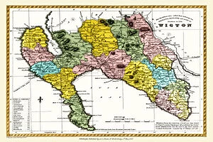
Background imageMap Collection: Old County Map of Wigtown Scotland 1847 by A&C Black

Old County Map of Wigtown Scotland 1847 by A&C Black
A finely detailed facimile remastered in full colour from an antique original map of Wigtownshire featured in A&C Blacks Atlas of 1847

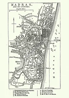
Background imageMap Collection: Map of Madras (Chennai), India, 19th Century

Map of Madras (Chennai), India, 19th Century
Vintage engraving of Map of Madras (Chennai), India, 19th Century

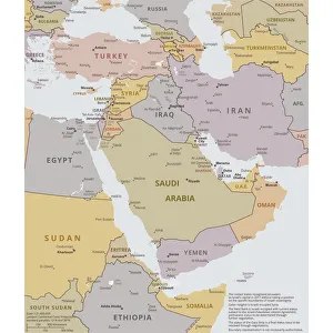
Background imageMap Collection: Political map of The Middle East

Political map of The Middle East
Vector illustration of the policital map of The Middle East Reference map was created by the US Central Intelligence Agency

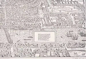
Background imageMap Collection: Agas Map of London, c1561

Agas Map of London, c1561. Sheet 10, showing part of Southwark, London Bridge, ships on the River Thames, part of the City of London and the Tower of London with its moat

Background imageMap Collection: The Babylonian Map of the World, c. 510-c. 500 BC. Artist: Assyrian Art

The Babylonian Map of the World, c. 510-c. 500 BC. Artist: Assyrian Art
The Babylonian Map of the World, c. 510-c. 500 BC. Found in the collection of British Museum

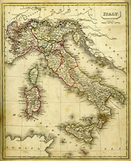
Background imageMap Collection: Antquie Map of Italy

Antquie Map of Italy
Vintage map of Italy fron 1837

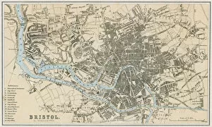
Background imageMap Collection: Bristol map, 1878

Bristol map, 1878
A map of Bristol in 1878. Date: 1878

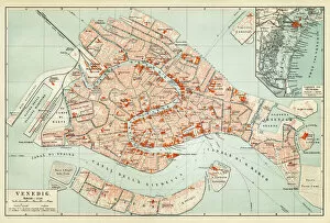
Background imageMap Collection: Map of Venice 1897

Map of Venice 1897
Map of the city of Venice, Italy

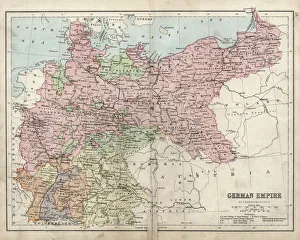
Background imageMap Collection: Antique damaged map of German Empire 19th Century

Antique damaged map of German Empire 19th Century

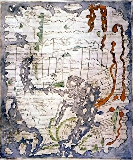
Background imageMap Collection: WORLD MAP, 11th CENTURY. The Cottonian or Anglo-Saxon World Map

WORLD MAP, 11th CENTURY. The Cottonian or Anglo-Saxon World Map

Background imageMap Collection: Tourist map of Bergen, Norway

Tourist map of Bergen, Norway
Tourist map (TKT - Turisttrafikkomiteen) of Bergen, Hordaland County, Norway. Date: 1951

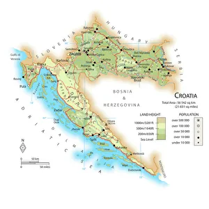
Background imageMap Collection: Map of Croatia

Map of Croatia

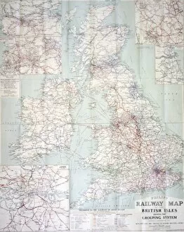
Background imageMap Collection: Railway map of Britain

Railway map of Britain
Philips railway map of the British Isles, c1923 Date: c. 1923

Background imageMap Collection: Map of the Coronation ritual within Westminster Abbey

Map of the Coronation ritual within Westminster Abbey
A panoramic view inside Westminster Abbey to show the position, movements and sequence of ceremonies (indicated by numbers) of the Coronation ceremony of King George VI. Date: 1937

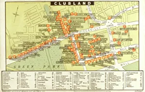
Background imageMap Collection: A map of Ladies and Gentlemans Clubs of London

A map of Ladies and Gentlemans Clubs of London
A map of Ladies and Gentlemans Clubs of the West End of London - Clubland. Date: circa 1910

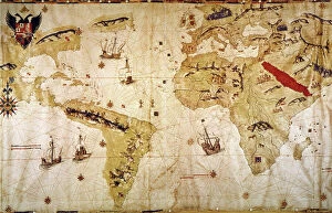
Background imageMap Collection: VESPUCCIs WORLD MAP, 1526. Juan Vespuccis world map, 1526

VESPUCCIs WORLD MAP, 1526. Juan Vespuccis world map, 1526

Background imageMap Collection: VENICE: MAP, 17TH CENTURY. Map of Venice by Guiseppe Heintz, 17th century

VENICE: MAP, 17TH CENTURY. Map of Venice by Guiseppe Heintz, 17th century

Background imageMap Collection: Barbarossa-Era Italy Map

Barbarossa-Era Italy Map
A map of Italy in the reign of Holy Roman Emperor Friedrich I, known as Barbarossa

Background imageMap Collection: Map of the Scilly Isles

Map of the Scilly Isles
Vintage map from 1880 of the Scilly Isles an archipelago off the southwestern tip of the Cornish peninsula of Great Britain

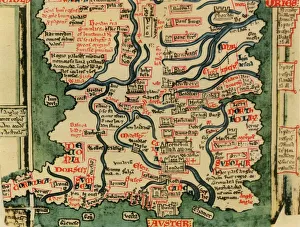
Background imageMap Collection: Matthew Pariss Map of Great Britain showing rivers & towns in the south of England & part of

Matthew Pariss Map of Great Britain showing rivers & towns in the south of England & part of Wales, c. 1250 (1944)
Many place-names are still recognisable today. The word Auster, written over the English Channel at the bottom, refers to wind bringing heavy cloud cover and fog

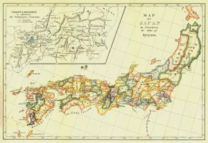
Background imageMap Collection: Map of Japan in Provinces in time of Iyeyasu, 1903. Creator: Unknown

Map of Japan in Provinces in time of Iyeyasu, 1903. Creator: Unknown
Map of Japan in Provinces in time of Iyeyasu, 1903. Tokugawa Ieyasu (1543-1616) first shogun of the Tokugawa shogunate which ruled Japan from 1600-1868 and is known as the Edo period

Background imageMap Collection: Map of Italy, 1902. Creator: Unknown

Map of Italy, 1902. Creator: Unknown
Map of Italy, 1902. Showing the various administrative regions, the islands of Sardinia and Sicily, with inset of Rome. From The Century Atlas of the World. [John Walker & Co, Ltd. London, 1902]

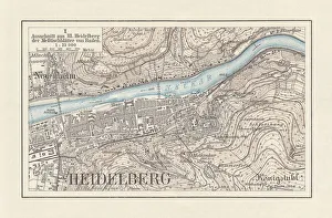
Background imageMap Collection: Historical city map of Heidelberg, Baden-WAOErttemberg, Germany, lithograph, published 1897

Historical city map of Heidelberg, Baden-WAOErttemberg, Germany, lithograph, published 1897
Historical city map of Heidelberg, Baden-WAOErttemberg, Germany. Lithograph, published in 1897

Background imageMap Collection: Map of Saint Lucia, 19th Century

Map of Saint Lucia, 19th Century
Vintage engraving of Map of Saint Lucia, 19th Century

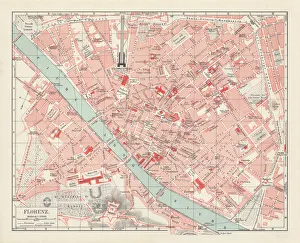
Background imageMap Collection: City map of Florence, Italy, lithograph, published in 1897

City map of Florence, Italy, lithograph, published in 1897
City map of Florence - capital city of the Italian region of Tuscany. Lithograph, published in 1897

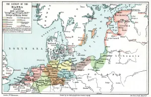
Background imageMap Collection: Map of the extent of the Hanseatic League in about 1400

Map of the extent of the Hanseatic League in about 1400. The Hanseatic League was an alliance of about 100 north German towns and trading interests important in northern Europe from the 13th century

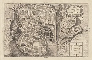
Background imageMap Collection: Map of the ancient Jerusalem, copperplate engraving, published in 1774

Map of the ancient Jerusalem, copperplate engraving, published in 1774
Map of the ancient Jerusalem. Copperplate engraving, published in 1774

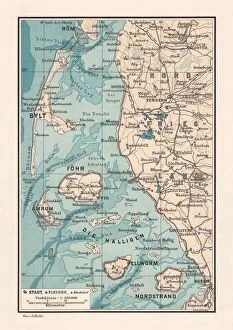
Background imageMap Collection: Northern Friesland (Nordfriesland), and islands, Schleswig-Holstein, Germany, lithograph

Northern Friesland (Nordfriesland), and islands, Schleswig-Holstein, Germany, lithograph, published 1887
North Frisian Islands and Northern Friesland (Nordfriesland), the northernmost district of Germany, part of the state of Schleswig-Holstein. Lithograph, published in 1887

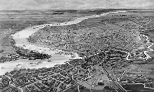
Background imageMap Collection: Shanghai, international settlements 1932

Shanghai, international settlements 1932
Shanghai - the storm centre: an international settlement under the protection of fourteen powers, the chief scene of the Sino-Japanese conflict

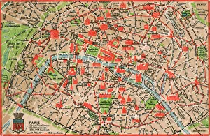
Background imageMap Collection: Map of Paris in 1908 with geographic and demographical data

Map of Paris in 1908 with geographic and demographical data
Map of Paris in 1908 with geographic and demographic data featured (as well as the location of all of the major sites in the city centre). Date: 1908

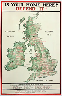
Background imageMap Collection: WWI Poster, Is your home here? Defend it

WWI Poster, Is your home here? Defend it
Is your home here? Defend it! Parliamentary Recruiting Committee poster with a map showing the different regiments and HQs where men can enlist. Date: 1916

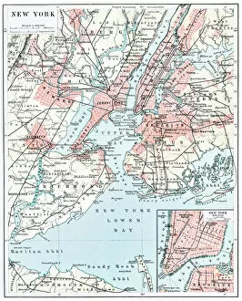
Background imageMap Collection: Map of New York city 1896

Map of New York city 1896
Ilustration of a Map of New York city 1896

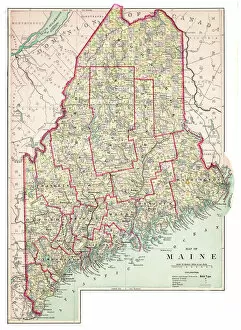
Background imageMap Collection: Map of Maine USA 1883

Map of Maine USA 1883
Warrens Common School Geography

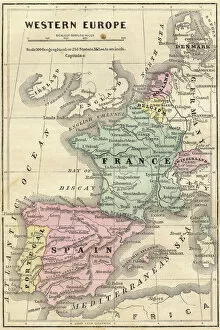
Background imageMap Collection: France Spain Portugal map 1856

France Spain Portugal map 1856
Colton and Fitchs Modern School Geography by George W. Fitch - New York 1856

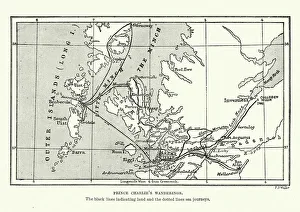
Background imageMap Collection: Map of Bonnie Prince Charlies Wanderings

Map of Bonnie Prince Charlies Wanderings
Vintage caricature of Map of Bonnie Prince Charlies Wanderings after his defeat at the Battle of Culloden in 1746

Background imageMap Collection: Antique map of Hadrians wall

Antique map of Hadrians wall

Background imageMap Collection: Iowa 1852 Map

Iowa 1852 Map

Background imageMap Collection: Antique map of Scotland

Antique map of Scotland, 1864

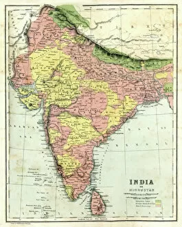
Background imageMap Collection: Antique map of India

Antique map of India, 1864

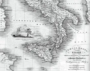
Background imageMap Collection: Vintage map of Magna Graecia

Vintage map of Magna Graecia, showing the settlements of the ancient greeks in Italy. Magna GrA|cia is the name of the coastal areas of Southern Italy on the Tarentine Gulf that was extensively

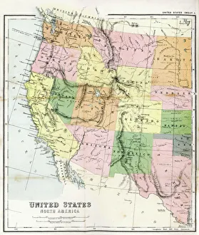
Background imageMap Collection: Antique Map of Western USA

Antique Map of Western USA
Antique Map from 1867 of Western United States of America

Background imageMap Collection: VIRGINIA MAP, 1612. Captain John Smiths map of Virginia, 1612

VIRGINIA MAP, 1612. Captain John Smiths map of Virginia, 1612

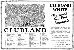
Background imageMap Collection: Clubland White Port advertisement

Clubland White Port advertisement
Advertisement for Clubland White, the finest old port procurable...to be found among the members of Londons celebrated West End Clubs

Background imageMap Collection: WORLD MAP. Pre-Christian era, c450 B. C. according to the writings of Herodotus

WORLD MAP. Pre-Christian era, c450 B. C. according to the writings of Herodotus
WORLD MAP. Pre-Christian era, c450 B.C. according to the writings of Herodotus. A 19th century reconstruction

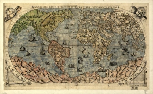
Background imageMap Collection: 16th century world map

16th century world map
World map, published around 1565 in Venice, Italy, by Italian mapmaker Ferando Bertelli. The title of the map: Universale Descrittione di Tutta la Terra Conosciuta Fin Qui

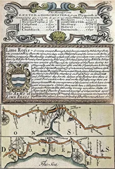
Background imageMap Collection: 1720 Lyme Regis early map of coast

1720 Lyme Regis early map of coast
Copperplate engraving from 1720 Emanuel Bowen and John Owen in " Britannia Depicta". Lyme Regis early 18th century map showing the Jurassic coast focussing on Lyme Regis

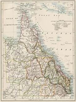
Background imageMap Collection: Queensland, Australia, 1800s

Queensland, Australia, 1800s
Map of Queensland, Australia, 1870s. Color lithograph reproduction of a 19th-century illustration

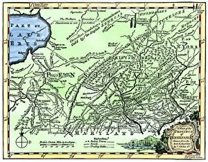
Background imageMap Collection: Colonial Pennsylvania map, 1750s

Colonial Pennsylvania map, 1750s
Map of the " Province of Pennsilvania, " 1756. Hand-colored 19th-century woodcut reproduction of an 18th-century illustration


All Professionally Made to Order for Quick Shipping

"Journey through Time and Space: Exploring the World of Maps" Maps have been an essential tool for centuries, guiding us through uncharted territories and helping us understand our world. From the Thirteen original colonies in 1776 to William Smith's groundbreaking Geological Map, these visual representations have shaped our understanding of geography, history, and even ourselves. Step onto a Reflexology foot map, where every pressure point tells a story about our well-being. Or immerse yourself in the intricate details of Richard de Bello's masterpiece - The Hereford Mappa Mundi (c1285), a medieval treasure that showcases both geographical knowledge and artistic finesse. Travel back in time with antique maps like the Roman Empire or Britain under the Anglo Saxons; they offer glimpses into ancient civilizations that once thrived. And let's not forget the Falkland Islands Royal Engineer briefing map from 1982, reminding us how maps play crucial roles during times of conflict. Delve into Al-Idrisi's world map from 1154 or explore GWR Network Map from c1920s - each capturing different eras' perspectives on global connectivity. Swindon Works Map from c1940s takes you behind-the-scenes of industrial revolution marvels. Finally, lose yourself in a mesmerizing journey across Ancient Greece as you trace your finger along its contours on an old parchment-like map. Discover mythical lands and legendary tales that still resonate today, and are more than just navigational aids; they are gateways to exploration and understanding. They tell stories of triumphs, discoveries, cultures lost to time but preserved within their lines. So next time you unfold a map or scroll through digital coordinates (like EXPL2A-00352), remember that you hold much more than directions – you hold pieces of history waiting to be explored anew.