Home > North America > Mexico > Maps
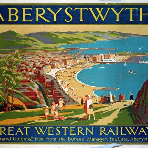
Official railroad map of the United States, Dominion of Canada and Mexico, 1890. Creator: Matthews, Northrup & Co (active 1890s). Official railroad map of the United States, Dominion of Canada and Mexico, 1890
. Official railroad map of the United States, Dominion of Canada and Mexico, 1890")
![]()
Wall Art and Photo Gifts from Heritage Images
Official railroad map of the United States, Dominion of Canada and Mexico, 1890. Creator: Matthews, Northrup & Co (active 1890s). Official railroad map of the United States, Dominion of Canada and Mexico, 1890
Official railroad map of the United States, Dominion of Canada and Mexico, 1890. Private Collection
Heritage Images features heritage image collections
Media ID 36358983
© Fine Art Images/Heritage Images
1890 Cartography Chromolithography History Of Rail Transport Matthews The United States Train Train Travel
FEATURES IN THESE COLLECTIONS
> North America
> Canada
> Maps
> North America
> Mexico
> Maps
> North America
> Mexico
> Related Images
> North America
> United States of America
> Maps
> Popular Themes
> Railway Posters
> Transportation
> Trains
EDITORS COMMENTS
This stunning chromolithograph map, created by Matthews, Northrup & Co in 1890, offers a captivating glimpse into the railroad networks of the United States, Dominion of Canada, and Mexico during a pivotal moment in transportation history. The intricate details of the map reveal the extensive reach of railways, connecting major cities and towns across the three countries. At the turn of the 19th century, rail transport was revolutionizing long-distance travel and commerce. The map's vibrant colors and meticulous labeling showcase the vast railroad networks that had already been established, as well as the ambitious expansion plans underway. The United States, in particular, saw an explosion in railroad construction during this period, with the transcontinental railroad having been completed just a few years prior. The map's title, "Official Railroad Map of the United States, Dominion of Canada and Mexico," underscores its authoritative status as a comprehensive guide for travelers and businesses seeking to navigate the expanding rail network. The map's scale allows for a clear view of the railroads' routes, stations, and connections, providing valuable information for those planning journeys across the continent. As a fine art image, this map is a testament to the skill and artistry of Matthews, Northrup & Co. The company's mastery of chromolithography, a printing technique that allowed for the production of detailed, multicolored images, is evident in the rich, vibrant hues and precise lines of the map. The map's historical significance, coupled with its aesthetic appeal, makes it an invaluable addition to any collection focused on cartography, graphic arts, or the history of rail transport.
MADE IN AUSTRALIA
Safe Shipping with 30 Day Money Back Guarantee
FREE PERSONALISATION*
We are proud to offer a range of customisation features including Personalised Captions, Color Filters and Picture Zoom Tools
SECURE PAYMENTS
We happily accept a wide range of payment options so you can pay for the things you need in the way that is most convenient for you
* Options may vary by product and licensing agreement. Zoomed Pictures can be adjusted in the Cart.