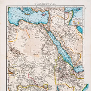
Home > Maps and Charts > World
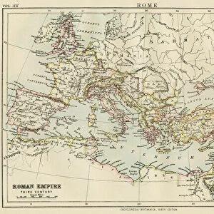
1864, Johnson Map of the Roman Empire, topography, cartography, geography, land, illustration

![]()
Wall Art and Photo Gifts from Liszt Collection
1864, Johnson Map of the Roman Empire, topography, cartography, geography, land, illustration
1864, Johnson Map of the Roman Empire
Liszt Collection of nineteenth-century engravings and images to browse and enjoy
Media ID 14007856
© Artokoloro Quint Lox Limited
1864 Antique Map Atlas Chart Geographic Latitude Longitude Mappa Mundi Old Antique Plan Old Antique View Old Map Ols Antique Map Rare Old Maps Topo
FEATURES IN THESE COLLECTIONS
> Maps and Charts
> Early Maps
> Maps and Charts
> World
EDITORS COMMENTS
This print showcases the 1864 Johnson Map of the Roman Empire, a true masterpiece in topography, cartography, and geography. With intricate details and stunning precision, this illustration takes us back to ancient times when the world was vastly different. The map's vintage charm is evident through its aged paper and retro aesthetic. It serves as a portal to history, allowing us to explore the vast lands that once comprised the mighty Roman Empire. Every line on this old antique view represents an incredible journey or discovery made by our ancestors. As we gaze upon this decorative piece of art, we can't help but marvel at how it captures not only geographical features but also the spirit of exploration that defined those times. The grid-like structure with latitude and longitude lines adds a touch of geometric elegance to this historic navigation tool. Meticulously crafted like an atlas from another era, this rare old map transports us into a forgotten space where regions were shaped differently than they are today. It reminds us of the importance of preserving historical artifacts like mappa mundi for future generations' understanding. Whether you're a history enthusiast or simply appreciate fine craftsmanship, this Johnson Map print is sure to captivate your imagination and transport you back in time.
MADE IN AUSTRALIA
Safe Shipping with 30 Day Money Back Guarantee
FREE PERSONALISATION*
We are proud to offer a range of customisation features including Personalised Captions, Color Filters and Picture Zoom Tools
SECURE PAYMENTS
We happily accept a wide range of payment options so you can pay for the things you need in the way that is most convenient for you
* Options may vary by product and licensing agreement. Zoomed Pictures can be adjusted in the Cart.