Fraud Blocker Skip to main content

Home > Europe > United Kingdom > England > London > Sights > British Museum

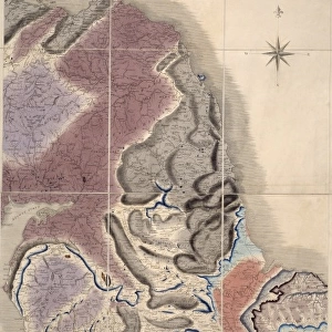
Geological map of Britain and Ireland

 : Geological map of Britain and Ireland
Sold 13
In Stock
We accept all major payment options so you can pay for the things you need in the way that is most convenient for you

Choose Your Product


Mary Evans Picture Library Photo Prints and Wall Art

Geological map of Britain and Ireland

Fig 9 from Britain Before Man (1978), a Geological Museum publication. Mary Evans Picture Library makes available wonderful images created for people to enjoy over the centuries. © Mary Evans Picture Library 2015 - https://copyrighthub.org/s0/hub1/creation/maryevans/MaryEvansPictureID/10706165

Media ID 8613371

Before Geological Geology Great Britain United Kingdom

FEATURES IN THESE COLLECTIONS

> Europe > Republic of Ireland > Maps

> Europe > United Kingdom > England > London > Sights > British Museum

> Maps and Charts > Geological Map

> Maps and Charts > Ireland

> Maps and Charts > Related Images

> Popular Themes > Geological

SECURE PAYMENTS
We accept all major payment options so you can pay for the things you need in the way that is most convenient for you

Made in Australia
Safe Shipping, Easy Returns

FREE PERSONALISATION
We are proud to offer a range of customisation including Cropping, Captions, and Filters. Zoom Cropping can be adjusted in the basket


Framed Prints of Geological map of Britain and Ireland

Discover the rich geological history of Britain and Ireland with our stunning Framed Print from the Media Storehouse collection. This captivating piece showcases Fig 9 from Britain Before Man (1978), a publication of the Geological Museum. Featuring the "Geological map of Britain and Ireland" by Rights Managed from Mary Evans Prints Online, this print is a must-have for geology enthusiasts and those who appreciate the wonders of the natural world. The high-quality print is expertly framed to preserve its vibrant colors and intricate details, making it a beautiful addition to any home or office. Delve into the fascinating story of the land beneath our feet with this exquisite Framed Print.


Photo Prints of Geological map of Britain and Ireland

Discover the fascinating geological history of Britain and Ireland with our exquisite Media Storehouse Photographic Print of Fig 9 from "Britain Before Man" (1978), a renowned publication by the Geological Museum. This striking image, rights managed from Mary Evans Prints Online, offers a detailed geological map that beautifully illustrates the complex layers and formations that shape our lands. Bring this captivating piece of geological art into your home or office to inspire curiosity and ignite conversations. Perfect for geologists, educators, or anyone with a love for the natural world.


Poster Prints of Geological map of Britain and Ireland

Discover the natural wonders of Britain and Ireland with our stunning Geological Map of Britain and Ireland print from the Media Storehouse collection. This captivating poster, sourced from the renowned Mary Evans Prints Online, is a replica of Fig. 9 from the classic publication "Britain Before Man" (1978) by the Geological Museum. Delve into the intricacies of the geological makeup of these two captivating islands, making this poster an essential addition to any home, classroom, or office space. Immerse yourself in the rich history and geological diversity that lies beneath your feet with this exquisite, high-quality print.


Jigsaw Puzzles of Geological map of Britain and Ireland

Discover the wonders of geology with our captivating jigsaw puzzles from Media Storehouse. This intriguing puzzle showcases a detailed geological map of Britain and Ireland, taken from Fig 9 of the renowned publication "Britain Before Man" (1978) by the Geological Museum. Bring the rich history of the land beneath your feet to life as you piece together the intricate geological layers, meticulously reproduced from the original Rights Managed image from Mary Evans Prints Online. Immerse yourself in the educational and engaging experience of solving this captivating puzzle, perfect for both seasoned puzzlers and those new to the hobby.

diamond
Made With High Grade Materials
thumb_up
Professional Quality Finish
package_2
Carefully Packed To Aid Safe Arrival

You May Also Like


William Smith Geological MapWilliam Smith Geological Map
Add to Basket
Antique colored illustrations: Geological map of England and WalesAntique colored illustrations: Geological map of England and Wales
Add to Basket
Battle of Waterloo map J020089Battle of Waterloo map J020089
Add to Basket
British Isles Counties, Districts and Unitary Authorities MapBritish Isles Counties, Districts and Unitary Authorities Map
Add to Basket
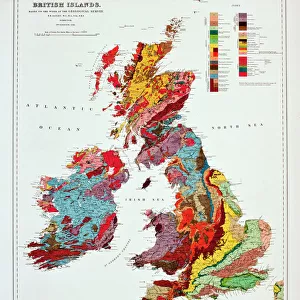
Geological map of the British IslandsGeological map of the British Islands
Add to Basket
Slaters Bridge, Little Langdale, Lake District, Cumbria, England, United Kingdom, EuropeSlaters Bridge, Little Langdale, Lake District, Cumbria, England, United Kingdom, Europe
Add to Basket
Butlers Wharf c. 1910 BB87_09668Butlers Wharf c. 1910 BB87_09668
Add to Basket
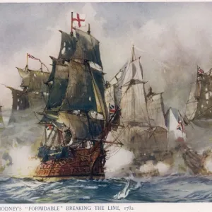
Naval Battle 1782Naval Battle 1782
Add to Basket
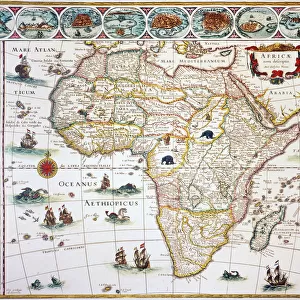
MAP OF AFRICA, 1630. Willem Blaeus ornamental map of Africa Newly DescribedMAP OF AFRICA, 1630. Willem Blaeus ornamental map of Africa Newly Described
Add to Basket
William Smiths Geological MapWilliam Smiths Geological Map
Add to Basket
William Smiths Geological MapWilliam Smiths Geological Map
Add to Basket
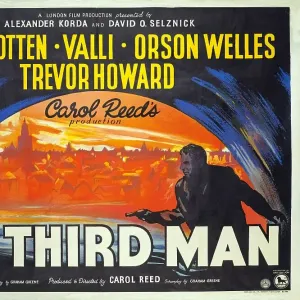
The Third Man PosterThe Third Man Poster
Add to Basket

Gallery Wall Inspiration

Poster - British Military medals
The Solway Coast - Kippford, BR (ScR) poster, 1948-1965
Penzance, BR poster, 1952
Woolacombe & Mortenhoe, 1960
Jubilee Procession in a Cornish Village, A. G. Sherwood Hunter (1846-1919)
1961 Triumph Bonneville T120R
British Railways network map 1950s
Sheringham, BR poster
Sidmouth, BR (SR) poster, 1959
Redcar, BR poster, 1958
Deal and Walmer, BR (SR) poster, 1952
Derbyshire, BR (LMR) poster, 1948-1965
St Andrews, BR poster, 1957
Freight train on the Welshpool & Llanfair Light Railway, by Selwyn Pearce-Higgins
Lancaster Castle, BR (LMR) poster, 1950
High Tide by Dutch painter Jan Toorop
Clapham Junction, BR (SR) poster, 1962
Fishguard-Rosslare, GWR poster, 1932
Glasgow Electric, BR (ScR) poster, c 1960
Yorkshire Dales, BR (NER) poster, 1953
Llandudno, BR poster, 1953
A China Clay Pit, Leswidden, Harold Harvey (1874-1941)
Waterloo Station, London, 1967
Military Badge
The Cairngorm Mountains, BR (ScR) poster, 1948-1965
1964 BSA Sunbeam scooter brochure. Creator: Unknown
The Harem, 1876. Creator: John Frederick Lewis

Discover Our Collections


Geological MapGeological Map
View Collection
GeologicalGeological
View Collection
MapsMaps
View Collection
Maps and Charts Related ImagesMaps and Charts Related Images
View Collection
British MuseumBritish Museum
View Collection
IrelandIreland
View Collection


© Copyright Media Storehouse, All Rights Reserved 2003 - 2025
Facebook     Pinterest     100% Payment Secure     Reviews IO