Home > Maps and Charts > Africa
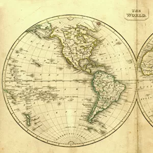
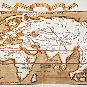
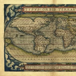
Antique Map of the World

![]()
Wall Art and Photo Gifts from Fine Art Storehouse
Antique Map of the World
Vintage map of the World from 1884
Unleash your creativity and transform your space into a visual masterpiece!
duncan1890
Media ID 13666647
© duncan1890
1880 1889 Asia Pac Chart Globe Globe Navigational Equipment Image Created 1880 1889 Manufactured Object Navigational Equipment North America Objects Equipment Past South America Styles The Americas Travel Locations World Map Image Created 19th Century Obsolete Victorian Style
FEATURES IN THESE COLLECTIONS
> Africa
> Related Images
> Asia
> Related Images
> Europe
> Related Images
> Fine Art Storehouse
> Map
> Historical Maps
> Maps and Charts
> Early Maps
> Maps and Charts
> World
> North America
> Related Images
> South America
> Related Images
EDITORS COMMENTS
This print titled "Antique Map of the World" takes us on a journey back in time to the 19th century. Created in 1884, this vintage map showcases the artistry and precision of cartography during that era. The intricate engravings and obsolete navigational equipment depicted on this image transport us to a world where exploration and discovery were at their peak. The Victorian style of this map adds an air of elegance and sophistication, reflecting the tastes and sensibilities of that period. With Asia, Europe, Africa, North America, South America, and the Americas beautifully illustrated across its horizontal layout, it serves as a visual testament to our planet's rich history. As we gaze upon this piece from Duncan1890's collection, we are reminded of how far we have come in terms of technology and knowledge about our world. It sparks curiosity about past travel locations while also serving as a reminder that even though times change rapidly, there is always something valuable to learn from the past. With no people present within its frame, this antique map invites us to explore on our own terms. Its presence evokes feelings of nostalgia for a bygone era when maps were cherished objects used for both practical navigation and aesthetic appreciation. In summary, "Antique Map of the World" by duncan1890 is not just an image; it is a portal into history - an exquisite representation of 19th-century cartography that captivates viewers with its beauty and historical significance.
MADE IN AUSTRALIA
Safe Shipping with 30 Day Money Back Guarantee
FREE PERSONALISATION*
We are proud to offer a range of customisation features including Personalised Captions, Color Filters and Picture Zoom Tools
SECURE PAYMENTS
We happily accept a wide range of payment options so you can pay for the things you need in the way that is most convenient for you
* Options may vary by product and licensing agreement. Zoomed Pictures can be adjusted in the Cart.